
Drone detection solutions are not interchangeable, because facilities do not share a mission. A correctional facility needs to find the person flying the drone. An airport needs to know whether an aircraft is where it should not be, fast enough to make a runway decision. A refinery needs a record that will hold up in a federal petition. Each mission points to a different combination of sensors, software, workflow, and records, and the most common failure in this category is buying a solution matched to a vendor's strengths instead of the buyer's mission.
This guide defines five detection missions, shows which solution composition each one demands, and gives the four-question method for matching any facility to its solution before a vendor is in the room. It sits under our guide to anti-drone system types, which covers what each sensor is; this one covers which ones to combine, and why.
Start With the Mission, Not the Sensor
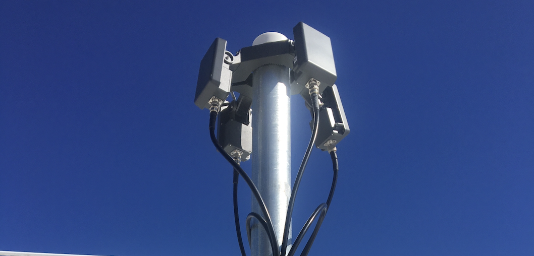
Every drone detection solution is built from the same components: radio frequency sensors that identify a drone and locate its pilot, radar that tracks any physical airframe, cameras that confirm and record, fusion software that turns the feeds into one picture, an alert workflow, and a records layer. What differs is the proportion, the placement, and what the system is optimized to produce. A solution that produces a superb positional track but no pilot location is an excellent airport solution and a poor prison one. Neither is better. One is matched and one is not.
The organizing question is: what decision does this facility need to make when a drone appears, and what does it need to be able to prove afterward? Five missions cover nearly every buyer.
Mission 1: Interdict the Operator
Who: correctional facilities, and increasingly hospitals and secure campuses facing contraband or surveillance flights. The decision: where to send a patrol, right now. What to prove: that a specific person flew a specific aircraft to this perimeter on this date, for prosecution. Solution composition: RF-led, with at least three direction-finding sensors placed for triangulation geometry around the perimeter, because pilot location is a function of sensor geometry, not sensor count. Radar added as fiber-optic contraband drones spread, since an operator flying a silent aircraft is still an operator standing somewhere. Cameras cued to the pilot bearing, not just the drone. Records that export as case files. The mismatch to avoid: a radar-heavy system that tracks the drone beautifully and never says where the pilot is. Details for this mission are on our prison drone detection page.
Mission 2: Protect an Operation
Who: airports, ports, and industrial sites where drones interrupt something expensive. The decision: hold or continue, made in seconds, by someone who was not watching the screen. What to prove: that the hold was justified, or that continuing was safe. Solution composition: radar-led for a continuous positional track regardless of what the drone transmits, fused with RF so the track carries an identity when one is available, cameras for visual confirmation before an operational decision, and above all an alert workflow that reaches operations staff on their existing systems rather than a separate dashboard. The Gatwick shutdown, roughly 1,000 flights and 140,000 passengers, happened at an airport that knew drones were present and could not track them. The mismatch to avoid: an RF-only solution, which goes blind exactly when a deliberate operator switches to an autonomous flight plan.
Mission 3: Protect a Crowd
Who: stadiums, arenas, festivals, and events. The decision: escalate or ignore, under time pressure, where every false alarm costs money and every miss costs more. What to prove: compliance with the temporary flight restriction and a clean response record. Solution composition: RF plus cameras during event windows, with fusion tuned aggressively for low false alarms, and a rehearsed handoff to the law enforcement partners who hold the enforcement authority. Detection here is episodic rather than continuous, which changes the economics: some venues rent capability for events rather than owning it. The mismatch to avoid: a system tuned for a quiet perimeter deployed into an RF environment with 60,000 phones, where an untuned solution alarms constantly and gets switched off by the second quarter.
Mission 4: Build a Case
Who: critical infrastructure: energy, water, chemical, and utilities. The decision: usually none in the moment; the drone is often gone before anyone could act. What to prove: a pattern, over months, that demonstrates specific vulnerability. This is the evidence a Section 2209 flight-restriction petition is won on, and the evidence that turns a security line item into a funded program. Solution composition: radar and RF for complete capture regardless of drone type, but with the records layer as the primary design object: retention measured in years, exportable incursion reports, pattern analytics that show frequency, timing, and repeat aircraft. The mismatch to avoid: a solution sold on real-time alerting to a facility whose actual need is a defensible archive.
Mission 5: Certify an Agency
Who: police departments, sheriffs, and state agencies pursuing authority under the federal rule effective July 1, 2026. The decision: whether a drone constitutes a credible threat, which is the legal trigger for any mitigation action. What to prove: that the determination was sound, to federal oversight. Solution composition: a detection system whose outputs are structured for the credible-threat determination: identity, track, pilot location, and a timestamped record, with equipment eligible for the federal Authorized Lists. Detection is not the preliminary step for a certifying agency; it is the system the authority runs on. The mismatch to avoid: buying mitigation equipment first and discovering that Tier 2 authority is unusable without the detection layer beneath it. The certification path is in our drone mitigation guide.
The Four-Question Matching Method
Before any vendor conversation, answer these in writing:
-
1. What is the threat, specifically? Contraband drops, surveillance, operational disruption, or pattern documentation. Different threats, different sensor emphasis.
-
2. What does the terrain do? Buildings, tree lines, and the local radio environment determine sensor placement and count. This is why every serious solution starts with a site survey, not a catalog.
-
3. Who decides, and how fast? A patrol sergeant in ninety seconds, an operations director in ten seconds, or a security manager reviewing monthly. The answer designs the workflow.
-
4. What must the record prove, and to whom? A prosecutor, an FAA petition reviewer, a grant evaluator, or federal oversight. The answer designs the records layer.
Four answers produce a specification a vendor can be held to, and they make quotes comparable, because a quote that does not address all four is describing a partial solution. What the complete solution includes, layer by layer, is in our guide to counter-UAS systems, and what it costs over five years is in our total cost of ownership guide.
Matched Solutions Get Used
The drone detection solutions still in daily use two years after installation share one trait: they were built for the decision their facility actually makes. Mismatched solutions do not fail loudly. They generate alerts nobody acts on, records nobody can use, and a line in next year's budget review asking what the system did.
We design the AirGuard platform to be composed to the mission, RF-led for interdiction, radar-led for operations, records-first for petitions, and we would rather lose a deal to a better-matched solution than win one that ends up switched off. The end-to-end deployment walkthrough is in our complete guide to detecting drones.
Want the four questions answered for your facility? Book a site survey and we will match the solution to the mission before anyone quotes a number.
Related reading: