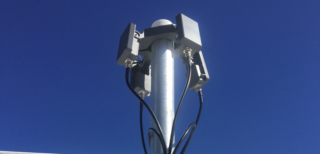
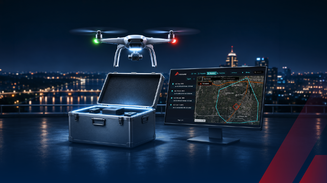
AirSight introduces AirSight Metro for DFR, a ready-to-integrate airspace awareness service for agencies running Drone as First Responder (DFR) programs. It brings together live drone detection from three Remote ID sensors, ADS-B data for manned aircraft, and Expanded Nationwide Drone Search in one affordable annual plan. Drone and pilot data is sent straight into your existing DFR platform, whatever platform you use.
You focus on the mission. We take care of airspace awareness.
The Challenges That Hold DFR Programs Back
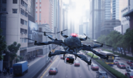
DFR drones launch into some of the busiest low airspace there is. Medevac and news helicopters, hobbyist drones, and other aircraft share that space, and most of them don’t share where they’re headed. When an unidentified drone shows up at a scene, there’s often no way to tell who is flying it, and no reliable record to build evidence that holds up later.
Agencies have also faced a costly trade-off. Affordable systems cover only part of the jurisdiction and leave gaps where aircraft go undetected, while wider-coverage systems cost more than the budget allows. The result: teams operate with limited information and struggle to back up enforcement.
DFR Programs Are Scaling. Airspace Awareness Needs to Scale With Them.
DFR adoption isn’t slowing down. Vertical Magazine reports that regulatory changes over the past year have driven a genuine surge in DFR programs nationwide, with police departments pointing to faster response times and better situational awareness before officers even arrive on scene. Charles L. Werner, director of DroneResponders, told the outlet that around 125 new DFR waivers are being approved every month now, roughly 1,500 a year, and that the pace is only expected to pick up. Chula Vista PD offers a good look at what that growth means in practice. The department launched the nation’s first DFR program back in 2018, and by May 2026 it had logged 25,000 flights, a figure likely to climb further as fire departments and utility companies start adopting the technology alongside police.
More DFR flights mean more aircraft sharing the same low airspace, and more drone incidents to investigate. AirSight Metro for DFR is built to give every one of those flights a clear picture of the airspace around it.
What AirSight Metro for DFR Delivers
Deconfliction on one screen
Three Remote ID sensors bring live drone detection to your coverage area, and ADS-B data, available through AirGuard’s integration with FlightAware, adds manned aircraft such as medevac helicopters. Your operator sees nearby drones and manned aircraft together on the AirGuard live map, before and during every flight, and can keep a safe distance from other traffic. For each manned aircraft, AirGuard shows its type, altitude, speed, heading, origin, destination and ICAO address.
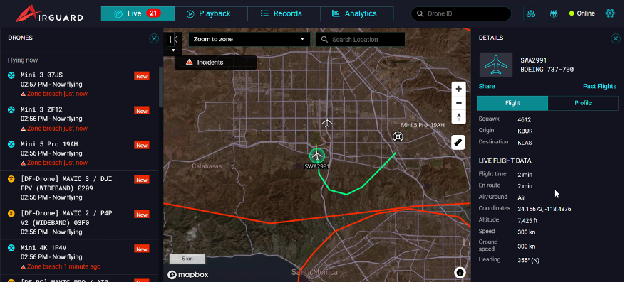
Manned aircraft and drones on the AirGuard live map
Drone detection data, integrated with your DFR system
When AirGuard detects a drone, it shares the data with your DFR platform within seconds: make and model, live drone location, altitude and flight path. Because Remote ID drones broadcast where their pilot is, your platform also gets the pilot’s location in real time. The operator reviews the data and sends a DFR unit straight to the drone or to the pilot.
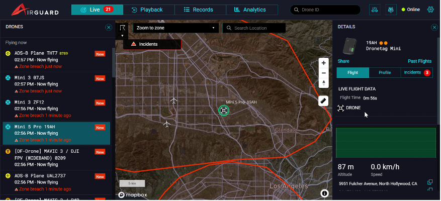
A detected drone and its details in AirGuard
Nationwide drone history for stronger investigations
Every detection is saved for review in AirGuard. Records, Playback and Analytics keep every logged drone flight on record, and manned aircraft flights can be reviewed in Records and Playback too, including altitude, flight ID, aircraft type, flight start and end times, and origin and destination. Expanded Nationwide Drone Search goes further: it shows where a drone detected in your zone has been seen across the country, with more than three years of data, so investigators can spot repeat offenders and build a case that holds up.
One affordable plan
AirSight Metro for DFR is $13,950 per year, billed annually on a 3-year plan, with no hidden fees. The plan includes:
- Three Remote ID sensors, typically covering 45–65 sq. mi. with overlapping 360° coverage, or any layout you need
- ADS-B data for manned aircraft
- Drone and pilot data integrated with your DFR platform
- Expanded Nationwide Drone Search, with 3+ years of data
- Records, Playback and Analytics in AirGuard
- Predictable pricing built for city budgets: A simple annual subscription with no hidden fees, built for city, county and town budgets.
- Launch every DFR flight with confidence: See nearby drones, manned aircraft and your DFR fleet in real time, so your operator can keep a safe distance from other traffic.
- Scalable by design: Start with the coverage you need now, and add sensors, features or capabilities as your program expands, with no need to tear out and rebuild.
Need more coverage later? Add sensors anytime as your program grows.
How It Works: From Detection to Launch
- Detect: Three Remote ID sensors pick up drones across your coverage area, and ADS-B adds manned aircraft.
- Send: The full picture reaches your DFR platform within seconds.
- Launch: Your operator sends a DFR unit to the exact drone or pilot location.
- Review in AirGuard: Back in AirGuard, Records and Playback keep every flight on record for investigations.
Built Around How DFR Teams Actually Work
“We created AirSight Metro for DFR because public-safety agencies running DFR programs already have enough to manage. It gives them the airspace awareness they need to fly safely and the evidence they need to back up enforcement, at a price that fits their budget.” - Robert Tabbara, Founder & CEO, AirSight.
The Case for Airspace Awareness in DFR Programs Today
DFR programs aren’t slowing down, and neither is the airspace around them. Whether you’re launching your first DFR program or scaling one across new launch locations, AirSight Metro for DFR gives you a clear picture of the airspace around every flight, drone data that goes straight to your DFR platform, and nationwide drone history for investigations, all in one affordable plan.
See how AirSight Metro for DFR delivers instant airspace intelligence, or book a live demonstration and see the difference for yourself.