Public Safety & Law Enforcement
Law Enforcement Drone Detection
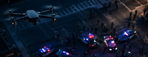
When a drone becomes a threat — over a crime scene, a public event, the border, or an officer's position — your agency is who responds. AirGuard gives law enforcement real-time intelligence on every drone and its pilot across your jurisdiction, turning airspace awareness into action and evidence.
The Law Enforcement Mission
Airspace Awareness Across Your Jurisdiction
Law enforcement agencies are the responders and investigators for an entire community. Officers protect locations that change by the day, confront adversaries who use drones to watch them, and build the cases that hold operators accountable. That mission calls for detection that can travel, intelligence that supports a response, and evidence that stands up in court — wherever the threat appears.
Armed & Weaponized Drones
Drones can be modified to carry and drop guns, chemicals, or explosives — turning a hobbyist aircraft into a weapon officers must anticipate.
Counter-Surveillance on Police
Gangs and cartels fly drones to spy on officers, track their whereabouts, capture video, and scout positions during operations.
Smuggling & Border Incursions
Drones move contraband across the border and into communities, with cartels running reconnaissance to route smugglers around checkpoints.
Built for the Mission
Where Law Enforcement Uses AirGuard
Law enforcement needs airspace awareness wherever the mission goes. AirGuard supports the full range of public-safety operations.

Mobile & Rapid-Deployment Operations
Crime scenes, motorcades, VIP visits, protests, and tactical operations all happen at locations that change by the day. AirSight's solar-powered Mobile Drone Detection Unit — a towable trailer with a 20-foot telescoping tower — can be set up by most vehicles and is operational within minutes, delivering autonomous 360° drone and pilot detection wherever the mission goes, with no need for external power.
Counter-Surveillance & Officer Safety
When criminals use drones to watch officers, AirGuard flips the script — alerting teams the moment a drone is observing them, and locating the operator so a surveillance attempt becomes an opportunity to make an arrest.
When criminals surveil the FBI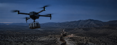
Border & Anti-Cartel Operations
Cartels deploy large numbers of drones to smuggle narcotics and conduct reconnaissance on agents. AirGuard detects these incursions, tracks their flight paths, and locates operators to support interdiction and investigations.
Border security & cartel drones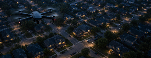
Investigations & Court-Ready Evidence
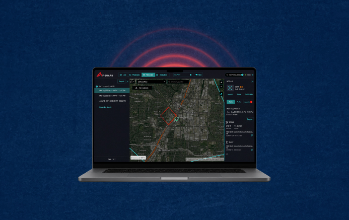
AirGuard logs and replays every drone's flight path, timing, and the operator's location — turning an incursion into a documented, prosecutable case with the intelligence officers need to identify and arrest the pilot.
Flight playback & digital evidenceHow AirGuard Works
Tiered Detection That Locates the Pilot
AirGuard layers multiple sensor technologies into one platform, giving officers full visibility — and, critically, the operator's location, which is what turns detection into an arrest.
Remote ID & RF Signal Detection
Identifies drones broadcasting FAA-mandated Remote ID and provides real-time alerts for drones operating near a target area or restricted zone.
RF Direction Finding & Pilot Location
Pinpoints the exact location of the drone operator, allowing officers to identify and stop unauthorized pilots — the decisive capability for enforcement.
Radar-Based Detection
Detects drones flying without communication signals, ensuring visibility even when criminals use stealth or signal-disabled UAVs.
24/7 Human-Verified Alerts
A live monitoring team verifies every detection, so officers respond to confirmed threats — with make, model, speed, altitude, and GPS in hand — not false alarms.
New Authority & Federal Funding
The SAFER SKIES Act Changes What Your Agency Can Do
Signed into law on December 18, 2025 as part of the FY2026 National Defense Authorization Act, the SAFER SKIES Act gives state, local, tribal, and territorial law enforcement a clear legal path to detect, track, and — once trained and certified — mitigate drones that pose a credible threat. Detection is the foundation of that authority: you cannot lawfully respond to what you cannot see.
For the first time, SLTT law enforcement agencies have a path to detect, track, and mitigate credible drone threats — authority previously held by only a handful of federal agencies.
FEMA has begun distributing counter-UAS grant funding to support detection, integration, and training — particularly for agencies tied to major 2026 events.
DHS and DOJ are due to publish implementing regulations — training standards and the authorized-equipment list — around mid-2026. Agencies evaluating detection now will be ready to act.
The Airsight Advantage
Intelligence That Supports the Response
AirGuard goes beyond conventional detection, giving officers the real-time intelligence to identify, track, and respond to unauthorized drone activity with precision.
Drone & Pilot Location
Pinpoint the GPS and Wi-Fi coordinates of both the drone and its operator for rapid situational awareness and enforcement.
Identification & Classification
Instantly detect and classify drones, with drone-type alerts that help officers prioritize threats faster.
Make, Model & Payload
Identify drone types and assess payload capabilities to gauge the level of risk each aircraft poses.
Real-Time Threat Monitoring
Track drone and pilot movements as they happen, with Copy Address functionality to share precise incident locations instantly.
Evidence & Trend Analysis
Record flight history for digital evidence and analyze activity trends over 120 days to map recurring patterns.
Integrates with Your Systems
Open architecture connects with RTCC, EOC, CAD, video, and incident-management platforms your agency already runs.
The Threat Landscape
Drones Are Already a Law Enforcement Problem
From the southern border to city streets, criminal use of drones is escalating faster than most agencies can respond.
Cartel drones a month at the border
Reports describe cartels deploying as many as a thousand drones a month across the southern border — smuggling contraband and tracking Border Patrol movements in real time to route around checkpoints.
Read on Airsight BlogWeaponized & kamikaze drones
Internal reporting has described cartel plans to use explosive-laden drones against agents — a dangerous escalation from smuggling tool to potential weapon.
Read on Airsight NewsCriminals surveilling officers
Criminal groups have used drones to monitor and surveil law enforcement — covering drone lights with tape to operate at night and scouting agent positions before moving contraband or people.
Read on Airsight NewsQuestions, Answered
Law Enforcement Drone Detection: FAQ
Common questions from police, sheriffs, and public-safety agencies about detecting and responding to drones.
Law enforcement uses drone detection to know what is flying over a scene, event, or operation — and, critically, where the operator is. AirGuard gives officers each drone's make, model, speed, altitude, and GPS location plus the pilot's position in real time, so they can gauge the threat, respond proactively, protect officers and the public, and gather evidence to identify and arrest unauthorized pilots. Because the system is deployable, agencies aren't limited to defending a single fixed building.
Yes — and for law enforcement this is the decisive capability. AirGuard's RF direction finding pinpoints the operator's location, and the platform reports the GPS and Wi-Fi coordinates of both the drone and the pilot. Locating the operator is what turns a detection into an arrest, an interdiction, or a prosecutable case, rather than just an alert that a drone is present.
The SAFER SKIES Act, signed into law on December 18, 2025 as part of the FY2026 National Defense Authorization Act, expands counter-UAS authority to state, local, tribal, and territorial law enforcement and correctional agencies. For the first time, these agencies have a path to detect, track, and — once trained and certified through a federal program — mitigate drones that pose a credible threat to people, events, critical infrastructure, or facilities. DHS and DOJ are expected to publish implementing regulations, including training standards and an authorized-equipment list, around mid-2026. Detection is the foundation of any lawful response, which is where AirGuard fits.
Yes. AirGuard detects and classifies drones in the airspace regardless of who is flying them, including drones used by criminal groups to surveil officers. It identifies the drone and locates the operator, so when a gang or cartel flies a drone to track police movements or scout an operation, the agency knows it is being watched and can respond — turning an attempted counter-surveillance into a chance to locate and stop the operator.
Mitigation — jamming, disabling, or downing a drone — has historically been restricted to a few federal agencies, and operating RF jamming equipment without authorization is a federal crime. The SAFER SKIES Act creates a path for state and local agencies to gain mitigation authority once personnel are trained and certified under a federal program, but full implementation depends on forthcoming rulemaking. In the meantime, detection, tracking, pilot location, and documentation are fully lawful and are the foundation any agency needs to respond appropriately and build a case.
Yes. Alongside the SAFER SKIES Act, FEMA has begun distributing counter-UAS grant funding to support detection, system integration, and training, with priority for agencies connected to major 2026 events. Federal grant programs generally fund detection and situational-awareness technology while prohibiting weapons purchases. Agencies that begin evaluating detection systems now will be positioned to use this funding and deploy once implementing regulations are finalized.
Airsight is a vendor-neutral validator that stress-tests detection equipment from global vendors and integrates only what proves reliable into the AirGuard platform — eliminating single-vendor lock-in. Its multi-layered approach combines Remote ID, RF detection, direction finding, and radar with a 24/7 expert monitoring team that verifies alerts. AirSight already works with state police and law enforcement agencies nationwide, and provides the deployable detection and pilot-location intelligence that public-safety operations depend on.
Equip Your Agency for the Aerial Threat
See how AirGuard gives your officers real-time drone and pilot intelligence across every operation. Book a demo or take our airspace detection solution for a spin.