Detecting a drone is only the first step. The real question is what happens next. Can you track it in real time? Can you classify whether it is a threat or a news photographer? Can you locate the operator? Can your security team respond before the drone reaches its target? The difference between a drone detection system that generates alerts and one that enables action is the tracking, identification, and response workflow that sits behind the initial detection.
We designed our platform around a principle that many organizations learn the hard way: detection without tracking is just an expensive alarm system. The full counter-drone response follows a workflow the Department of Defense calls DTIM - Detect, Track, Identify, Mitigate, codified in JIATF-401's counter-UAS operational doctrine. Each step depends on the one before it, and a failure at any stage breaks the entire chain. This guide walks through how each phase works in practice, what equipment powers it, and where most deployments fail.
Phase 1: Detection - Finding the Needle in the Sky
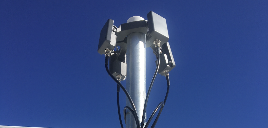
Detection is the moment a sensor first registers that something is in the airspace. Depending on your equipment configuration, this could be an RF analyzer picking up a drone's communication signal, a radar registering a small object, an acoustic sensor identifying propeller noise, or a Remote ID receiver capturing a broadcast identification packet.
The critical metric at the detection phase is time to first alert. From the moment a drone enters your detection envelope, how many seconds pass before an operator sees it on screen? In radar-based systems, this depends on scan rate and processing speed. RF systems like DZYNE's DTI system can detect drones up to 7 km away with real-time haptic, aural, and visual feedback. Phased array radars with electronic beam steering achieve scan times under one second, delivering near-instantaneous alerts.
The most common detection failure is not missing drones entirely - it is drowning operators in false alarms. Birds, weather, ground vehicles, and electromagnetic interference all trigger detections. As the Security Industry Association notes in its evaluation guide, a system with a high false positive rate will lead security personnel to ignore alerts entirely, regardless of its range or accuracy specifications. A single-sensor deployment that generates dozens of unvalidated alerts per shift will be functionally abandoned within a week. This is why layered detection with multiple sensor types is not a luxury - it is a prerequisite for an operational system.
Phase 2: Tracking - Maintaining Continuous Custody
Once a drone is detected, the system must maintain continuous "custody" of the target - knowing its position, altitude, heading, and speed in real time as it moves through the airspace. This is where the distinction between detection and tracking becomes critical.
Detection tells you a drone exists. Tracking tells you where it is going, how fast it is moving, whether it is approaching your facility or flying past, and where it came from. A radar might detect a drone at 3 kilometers, but if it loses the track when the drone drops below a treeline or enters a radar shadow, the security team is back to searching blind.
Effective tracking requires:
- Continuous sensor coverage with overlapping fields of view so that when one sensor loses the target, another picks it up. For perimeter protection, this often means multiple radar units covering adjacent sectors.
- Track fusion algorithms in the C2 platform that combine data from different sensors into a single, unified track. When radar provides range and bearing while RF provides drone model and operator location, the system must merge these into one target, not display two separate alerts.
- Camera cueing that automatically slews a PTZ camera to the drone's predicted position based on radar or RF data. This delivers visual confirmation without requiring an operator to manually search the sky.
The command-and-control platform is what makes tracking work at scale. Without sensor fusion, each detection modality generates its own independent track. An operator staring at three separate screens - one for radar, one for RF, one for cameras - cannot maintain situational awareness when multiple drones enter the airspace simultaneously. The C2 platform consolidates everything into a single operating picture with one fused track per target.
Phase 3: Identification - Classifying the Threat
Not every drone in your airspace is a threat. Commercial delivery drones, news helicopters, law enforcement UAS, and recreational hobbyists all share the same low-altitude airspace. Identification is the process of determining what the drone is, who is operating it, and whether it poses a risk.
The identification phase uses multiple data sources:
- RF fingerprinting matches the drone's communication signal against a library of known drone models. If the system identifies a DJI Mavic 3 broadcasting on standard frequencies, that is a very different threat profile than an unidentified signal on a non-standard frequency.
- Remote ID data provides the drone's serial number, registered operator, takeoff location, and flight path. A compliant drone with a registered operator near a permitted flight zone is almost certainly not a threat.
- Micro-Doppler classification from radar distinguishes drones from birds based on propeller rotation signatures, as we detailed in our radar guide.
- Visual identification through EO/IR cameras allows operators to assess payload, size, markings, and behavior. A drone hovering over a prison yard with a package attached presents a different response requirement than one flying over a highway.
The identification phase is where most organizations underinvest. Detection and tracking get the budget because they are tangible hardware purchases. But without reliable classification, every detection triggers the same response - and security teams quickly develop alert fatigue.
Phase 4: Response - From Intelligence to Action
The final phase turns situational awareness into a coordinated response. For most civilian organizations, "response" does not mean shooting down the drone. It means alerting the right people, documenting the incident, and initiating the appropriate protocol.
Under the SAFER SKIES Act, certified law enforcement agencies now have legal authority to mitigate (disable or redirect) drones in specific circumstances. But the vast majority of drone detection deployments at critical infrastructure sites, corporate campuses, and event venues focus on detection, tracking, and identification - then hand off to law enforcement if mitigation is needed.
An effective response workflow includes:
- Automated alerting that pushes notifications to security operations centers, field teams, and command staff based on threat classification level.
- Incident logging that records every detection with timestamp, sensor data, track history, camera footage, and operator actions. This creates a forensic record for law enforcement and regulatory reporting.
- Escalation protocols that define who is notified, what actions are authorized, and what external agencies to contact based on threat severity.
- Integration with existing security systems so that drone alerts appear alongside CCTV, access control, and intrusion detection in a unified security dashboard.
The Pentagon's JIATF-401 published guidance on standardizing the counter-drone testing and operational workflow, emphasizing that systems must filter and discard communication content to comply with federal surveillance laws. This is an important consideration for any organization deploying RF-based detection: the system must identify that a signal exists without decoding its content.
The DTIM workflow is already being deployed at scale. On the US southern border, JIATF-401 deployed $20 million in counter-UAS technology in just four months, including a network of 13 advanced sensors for detection and tracking paired with 7 mitigation systems for response. That is the DTIM chain operating in the field: sensors provide early warning, tracking maintains custody as drones cross the border, identification classifies the threat, and mitigation systems neutralize it before it reaches critical areas.
Where Most Drone Tracking Systems Fail
The DTIM workflow looks clean on paper. In practice, three failure modes account for most operational problems:
Failure 1: Sensor gaps create tracking blackouts. A single-panel radar typically covers a 90 to 120-degree sector, as noted in Robin Radar's counter-drone technology overview, leaving 240+ degrees unmonitored. A drone detected approaching from the north disappears when it circles to the east. Continuous tracking requires overlapping coverage, which means either multiple radar panels or a combination of radar and RF that covers the full 360-degree perimeter.
Failure 2: Lack of sensor fusion creates duplicate tracks. Without a C2 platform that merges data from different sensors, the same drone appears as three separate targets - one from radar, one from RF, one from cameras. Operators cannot tell whether they are dealing with one drone or three, and response protocols break down. This is the single most common failure in organizations that buy sensors from different vendors without investing in an integrated C2 platform.
Failure 3: Alert fatigue shuts down the human layer. A system that generates hundreds of unclassified alerts per day will be ignored. The identification phase is what separates actionable intelligence from noise. Organizations that skip classification - deploying detection and tracking without investing in identification capabilities - end up with expensive data that nobody acts on.
Building a Drone Tracking System That Works
The DTIM workflow is only as strong as its weakest phase. Before selecting equipment, map out how each phase will work at your specific site:
- Detection: What sensors will provide first alert? What is the expected false alarm rate in your environment? How will you validate detections before escalating?
- Tracking: Do you have 360-degree coverage? What happens when a drone enters a radar shadow or drops below treeline? How does the C2 platform handle track handoff between sensors?
- Identification: Can your system classify drone type and distinguish from birds? Do you have Remote ID receivers for compliant drones? Can cameras provide visual confirmation at the ranges your radar detects?
- Response: Who gets alerted? What are the escalation thresholds? Is the drone data integrated with your existing security infrastructure?
If you already know your protection tier, use our vendor evaluation framework to assess which providers deliver the full DTIM chain versus those that only sell individual sensors.
This is part of our series on deploying anti-drone systems by protection level and vertical. Explore the full library:
- Anti-Drone Systems: What Works at Every Protection Level
- Drone Detection Equipment: A Buyer's Guide
- Drone Detection Radar: How It Works, What It Costs, and Which Type You Need
Want to see the full DTIM workflow in action? Book a live AirGuard walkthrough with our team.