What is AirGuard?

AirGuard’s 4 Steps
to Secure your Airspace

Detect & Identify:
Detect Location,
Identify Threat and
Send Alerts
Classify Risk:
Drone Make & Model,
Payload Capacity,
Duration to Critical
Location
Track Drone Pilot:
Live Drone & Pilot GPS
Location Shown on the
Dashboard

Respond & Resolve:
Secure Area &
Follow SOP’s

Capabilities
of AirGuard
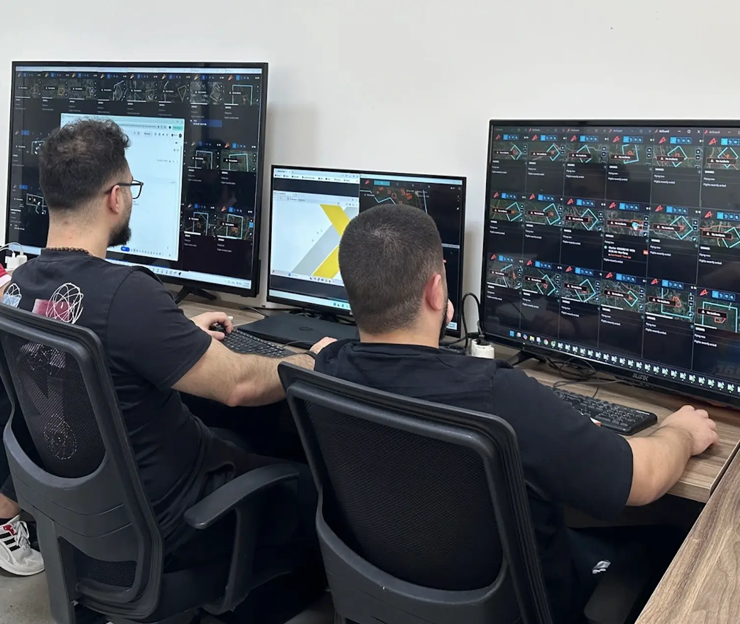
The AirGuard drone detection software platform utilizes multi-layered sensors that collect data on drones flying in the air. The AirGuard platform manages all sensor data and displays it in one easy to use interface.
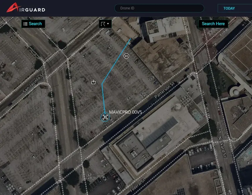
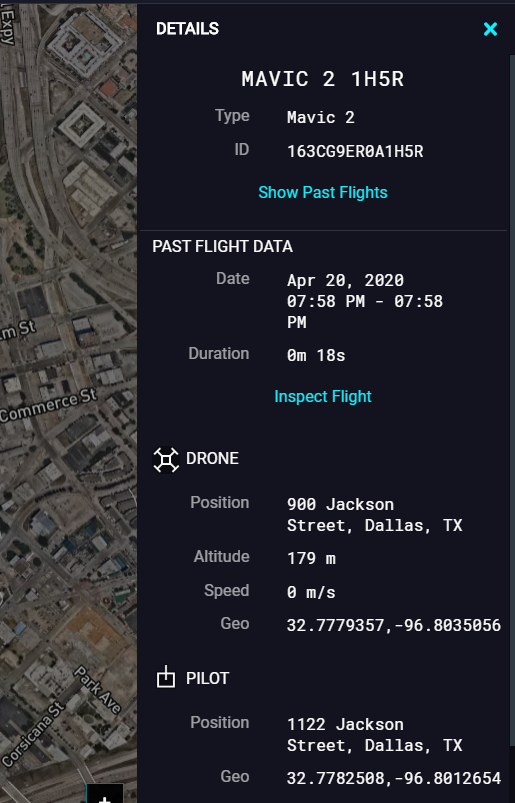
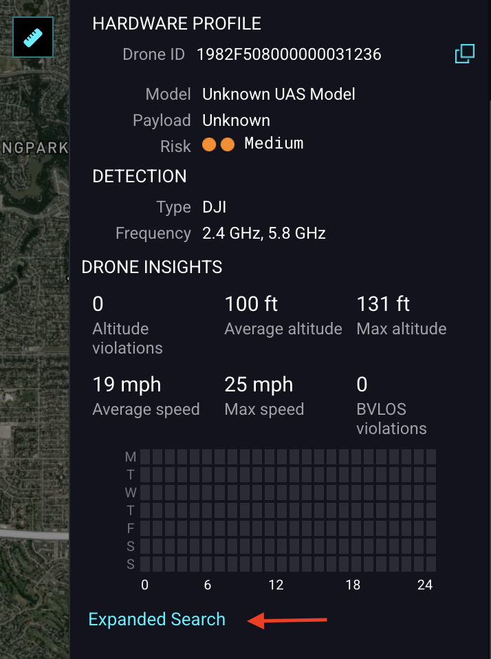
If a drone enters your area, AirGuard gives you Real-Time Data about the Drone GPS Location, Pilot GPS Location, as well as Drone data like Make and Model, Altitude and Speed.
AirGuard has a robust Flight History & Playback feature, so you can access all past drone incidents.AirGuard is scalable based on client requirements and budget. AirGuard can cover one site, multiple sites or even the entire city. It can utilize a single sensor or multiple sensors based on client’s security needs and budget.
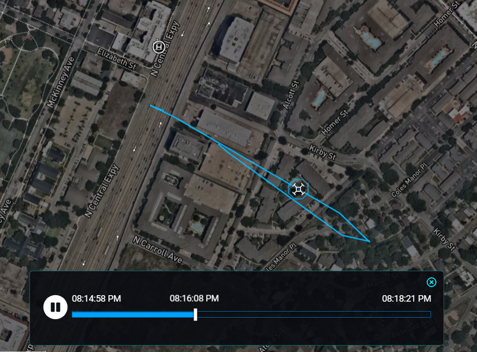
Flight History & Playback
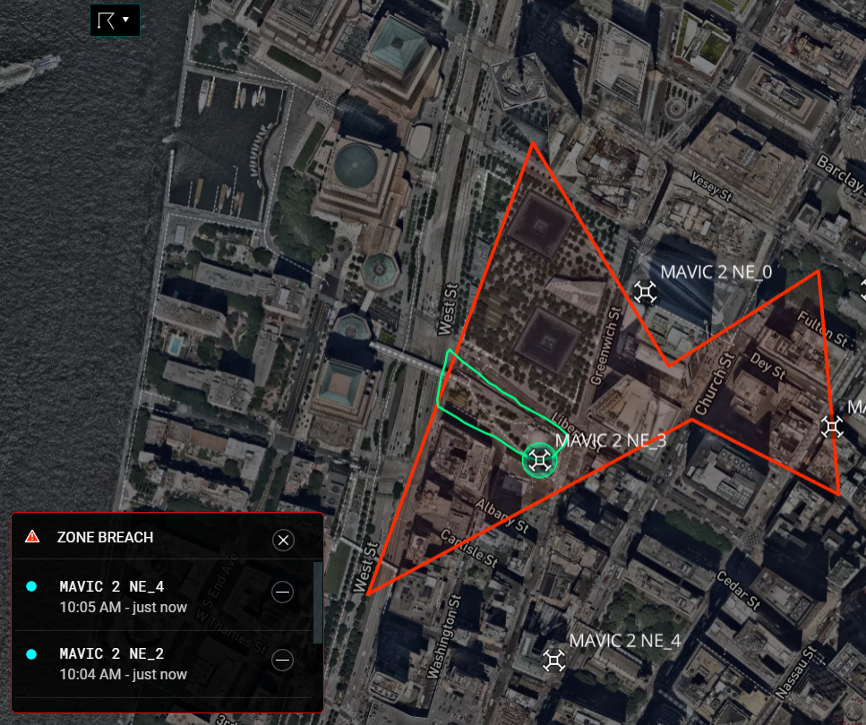
GeoFencing & Alerts
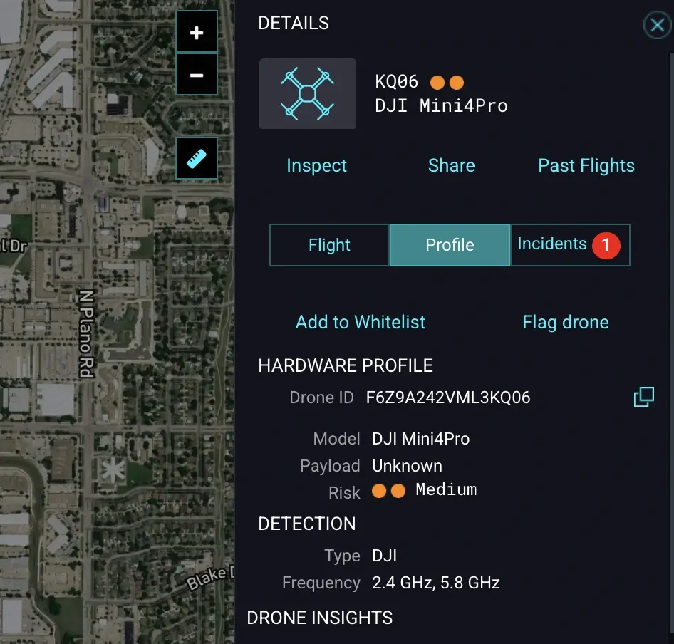
Drone Whitelisting & Flagging
Expanded Nationwide Search
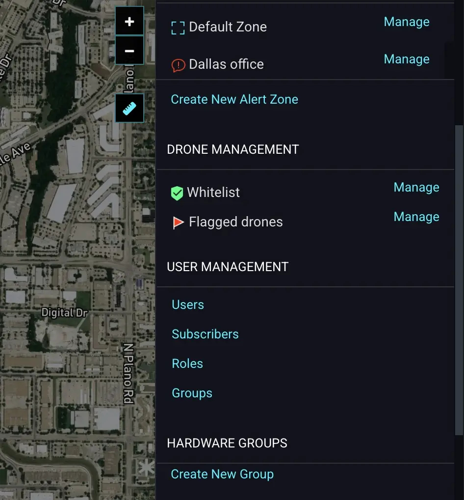
Advanced User Management & Permissions
Verified Alerts with 24/7 Human Monitoring
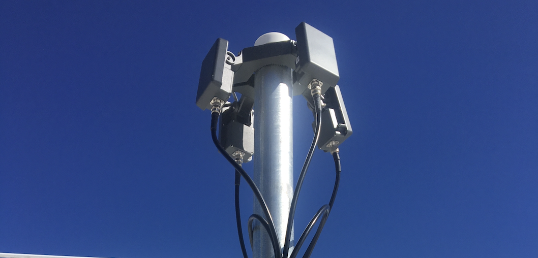
Hardware Layers of the
AirGuard Drone Detection Platform
We partner with best-in-class manufacturers to provide a hardware-agnostic, multi-layered detection shield that adapts to your specific security needs.
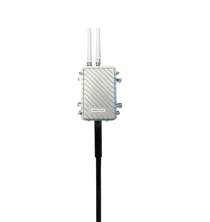
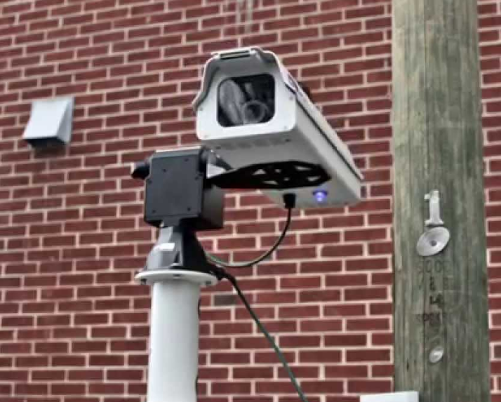
Remote ID Compliance
The foundational layer. Detects all new compliant drones and older models updated with FAA-required Remote ID firmware. Provides precise drone and pilot GPS location within a 2-to-5-mile range.

RF/DF Detection
Detects non-compliant, "silent," and DIY drones. Our sensors identify specific RF protocols to pinpoint the drone and pilot location, expanding coverage up to 10km (6 miles).
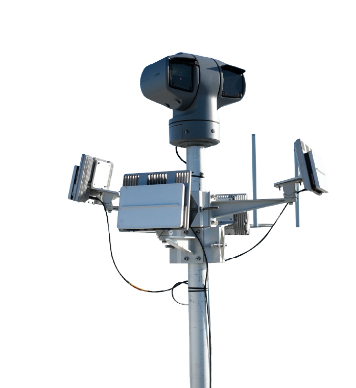
Radar with Visual Camera
The ultimate defense. Radar detects all flying objects, including non-RF "Dark Drones". Triggers visual verification backed by AI classification and 24/7 human monitoring.
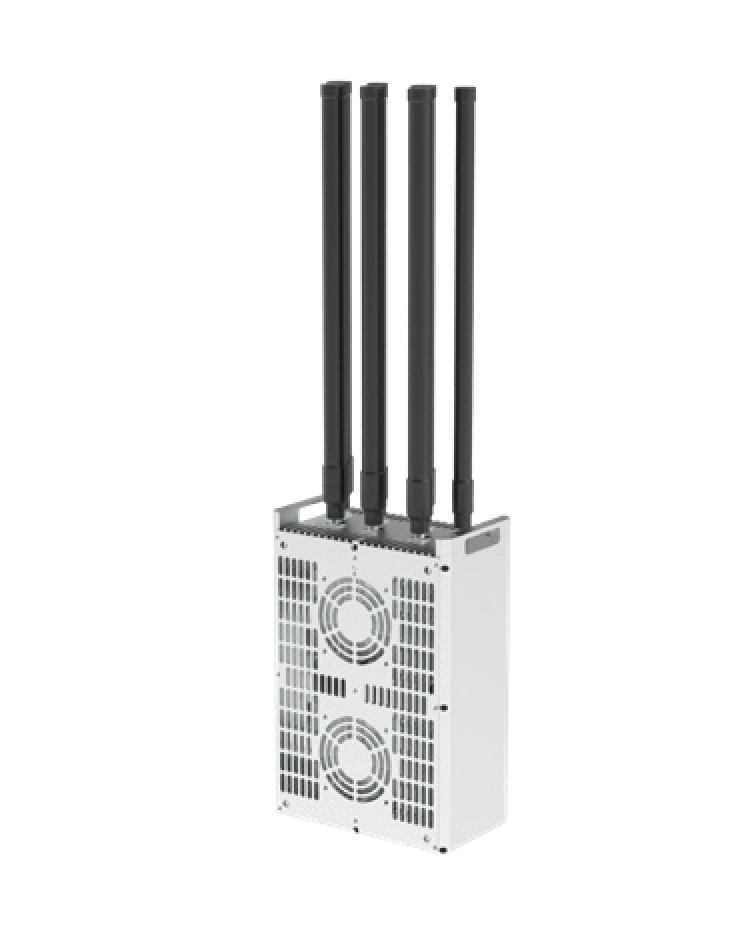
Smart & Autonomous Mitigation
Neutralize hostile threats with multi-band frequency jamming. Features full 360° airspace defense with a range of up to 1.9 miles, disrupting GNSS systems to force a land or return-to-home.
FCC & FAA Compliance Notice
IMPORTANT NOTICE REGARDING RF JAMMING DEVICES:
The marketing, sale, possession, and use of radio frequency (RF) jamming equipment is strictly regulated under United States federal law. Pursuant to the Communications Act of 1934, as amended (47 U.S.C. § 301, 302a, 333), the operation, marketing, or use of devices designed to block, jam, or interfere with authorized radio communications is prohibited except by certain authorized federal government entities.
The Federal Communications Commission (FCC) prohibits the operation, marketing, or sale of jamming equipment to the general public. Additionally, the Federal Aviation Administration (FAA) strictly regulates interference with aircraft communications, navigation, and unmanned aircraft systems (UAS). Unauthorized interference with aircraft or drone communications may violate federal law and subject violators to significant civil and criminal penalties.
Products described on this website are available only to qualified U.S. federal government agencies or other entities expressly authorized by federal law. These products are not available for purchase by state or local agencies, private entities, or individual consumers unless expressly permitted by applicable federal law.
By inquiring about or purchasing any such product, you represent and warrant that you are legally authorized to purchase and possess such equipment under applicable federal law.
How Does AirGuard help you respond to aerial drone threats?
AirGuard empowers your team to track both drones and pilots to respond proactively to threats before they can cause damage. Our solution provides real-time insights and customizable features that help secure your airspace, allowing you to make informed, data-driven decisions for enhanced threat response.
AirGuard empowers your team to track both drones and pilots to respond proactively to threats before they can cause damage. Our solution provides real-time insights and customizable features that help secure your airspace, allowing you to make informed, data-driven decisions for enhanced threat response.
-
Visualize the threat by distance.
-
Create warning and alert zones.
-
Create SOP based on actionable data.
-
Detailed flight path history.
-
Pilot historical location.
-
Special Interest location heatmaps.
-
Improve SOP’s based on Analytics and Data.
-
Integrate into other security systems.