.webp)
Detecting drones may sound simple — you point radar in the sky, it bounces signals off objects, and voilà, you track the drone. But in reality, detecting drones with radar systems is far from straightforward. Many factors influence how effectively a radar system identifies drones, especially since not all drones are created equal.
One of the most critical variables is the Radar Cross-Section (RCS), which measures how well an object reflects radar signals. Think of it like this: RCS is the "radar shadow" a drone casts. Larger, metal-heavy drones cast a big shadow, making them easier to detect, while small, plastic, or carbon-fiber drones barely leave a trace. Let’s explore why RCS makes drone detection tricky and how AirSight’s technology addresses this challenge.
What Affects a Drone’s RCS?
- Size and Shape:
Drones come in all sizes — from palm-sized racing drones to large industrial UAVs. Larger drones typically have a bigger RCS, making them more radar-visible. However, it’s not just size that matters. The shape of a drone, including the propellers, scatters radar waves unpredictably, causing fluctuating readings. Quadcopters, with their spinning blades, are notorious for producing inconsistent RCS values. - Construction Materials:
Materials play a major role in a drone's radar signature. Metal-bodied drones reflect radar signals effectively, resulting in higher RCS values. In contrast, plastic or carbon-fiber drones absorb more radar energy, significantly lowering their RCS. Add stealth coatings into the mix, and even military-grade radar systems may struggle to detect these elusive targets. - Flight Behavior:
Ever noticed how a hovering drone seems almost stationary? That’s a radar detection nightmare. High-speed maneuvers and hovering change how radar signals bounce back, complicating detection. Drones flying close to the ground can also blend into ground clutter, making them harder to distinguish from other objects.
The Range of Radar Cross-Section Values
To put things into perspective:
- Nano and Micro Drones: These tiny drones have incredibly low RCS values — somewhere between 0.0001 and 0.01 square meters. For radar, this is like spotting a large insect in a forest, making detection extremely difficult.
- Commercial Airliners: A Boeing 747 can have an RCS of up to 10,000 square meters, making it one of the easiest targets to track.
- Fighter Jets (like the F-16): Moderate RCS values, ranging from 1 to 3 square meters, strike a balance between detectability and stealth.
- Stealth Bombers (B-2): Designed to disappear from radar, the B-2’s RCS can be as low as 0.0001 square meters, on par with tiny drones.
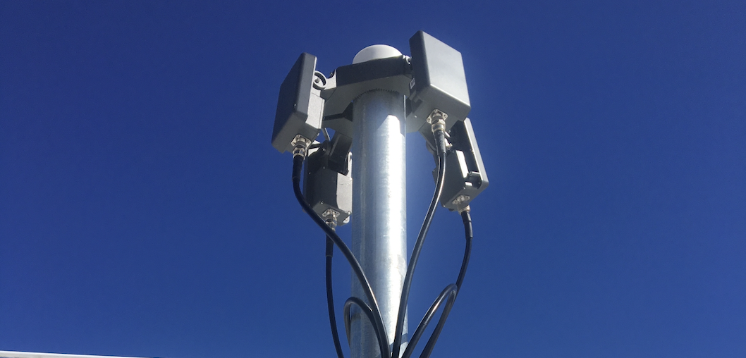
How AirSight Enhances Drone Detection Despite RCS Challenges
AirSight’s multi-layered detection system addresses these RCS challenges head-on. By combining multiple detection technologies, including Enhanced Remote ID, DF/RF sensors, and radar, AirSight ensures comprehensive drone detection, even when individual layers encounter limitations.
For example:
- Layer 1: Remote ID identifies drones broadcasting their location and identity, bypassing RCS limitations.
- Layer 2: DF/RF picks up control signals between a drone and its operator, providing pilot tracking.
- Layer 3: Radar complements the other layers by scanning vast airspace for objects, leveraging advanced processing techniques to differentiate drones from birds or ground clutter — even when RCS is minimal.
Moving Beyond Traditional Radar
With drones becoming increasingly stealthy, relying on radar alone isn’t enough. The key lies in sensor fusion, where technologies work together to create a robust detection picture. AirSight’s solutions integrate these layers seamlessly, providing better situational awareness and reducing false positives, ensuring security teams can respond quickly and confidently.
Detecting drones isn’t just about having radar. It’s about understanding the complexity of what radar sees — a game of size, shape, material, and motion. That’s why AirSight’s multi-layered approach, blending radar with signal and ID-based systems, offers a smarter path forward in drone detection.
For a full demo of our solution, contact our team and take the next step in securing your airspace!