Drone Detection &
Pilot Tracking Software
AirGuard By AirSight
AirGuard’s 4 Steps
to Secure your Airspace
Detect & Identify:
Detect Location,
Identify Threat and
Send Alerts
Classify Risk:
Drone Make & Model,
Payload Capacity,
Duration to Critical
Location
Track Drone Pilot:
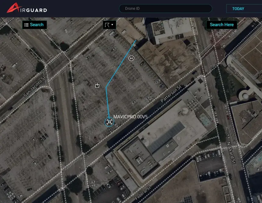
Live Drone & Pilot GPS
Location Shown on the
Dashboard
Respond & Resolve:
Secure Area &
Follow SOP’s

Capabilities
of AirGuard
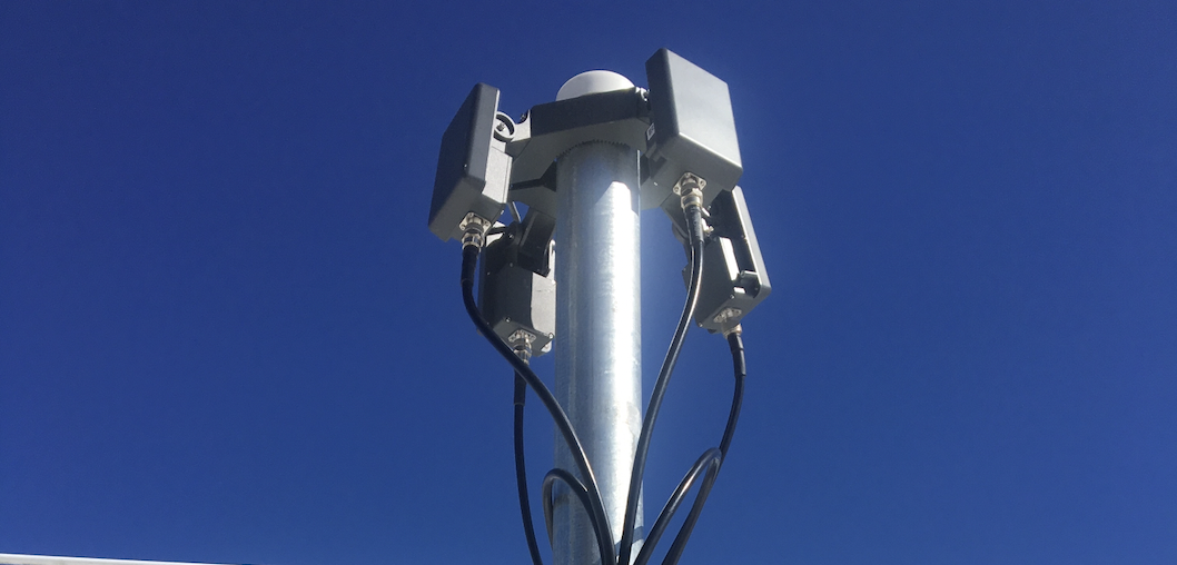
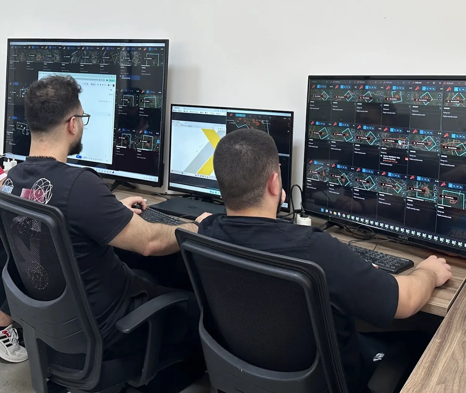
The AirGuard drone detection software platform utilizes multi-layered sensors that collect data on drones flying in the air. The AirGuard platform manages all sensor data and displays it in one easy to use interface.
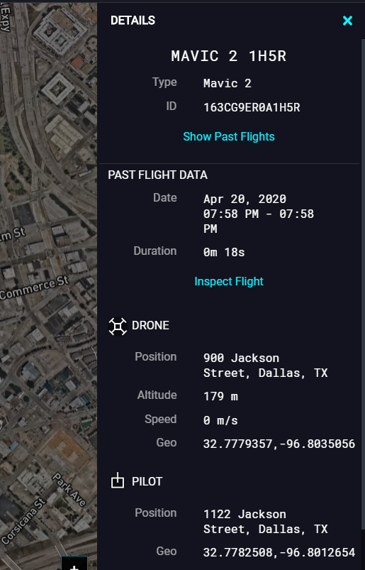
If a drone enters your area, AirGuard gives you Real-Time Data about the Drone GPS Location, Pilot GPS Location, as well as Drone data like Make and Model, Altitude and Speed.
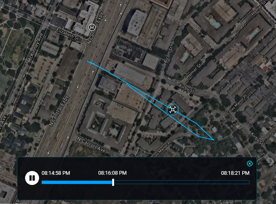
AirGuard has a robust Flight History & Playback feature, so you can access all past drone incidents.AirGuard is scalable based on client requirements and budget. AirGuard can cover one site, multiple sites or even the entire city. It can utilize a single sensor or multiple sensors based on client’s security needs and budget.
Flight History & Playback
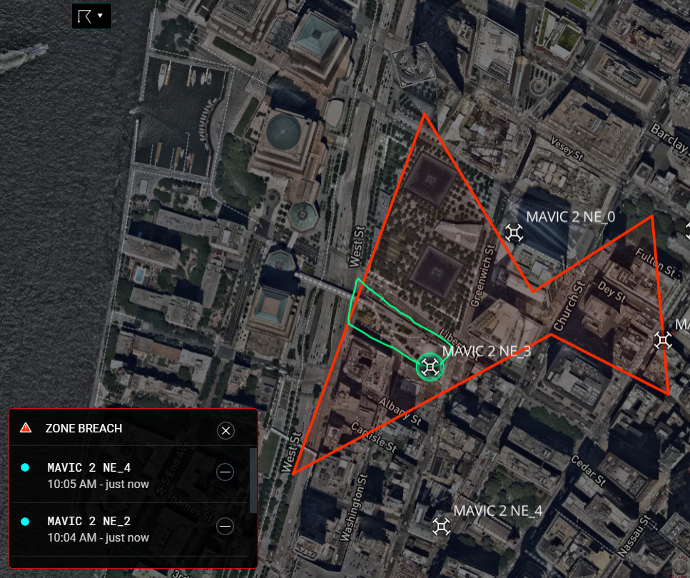
GeoFencing & Alerts
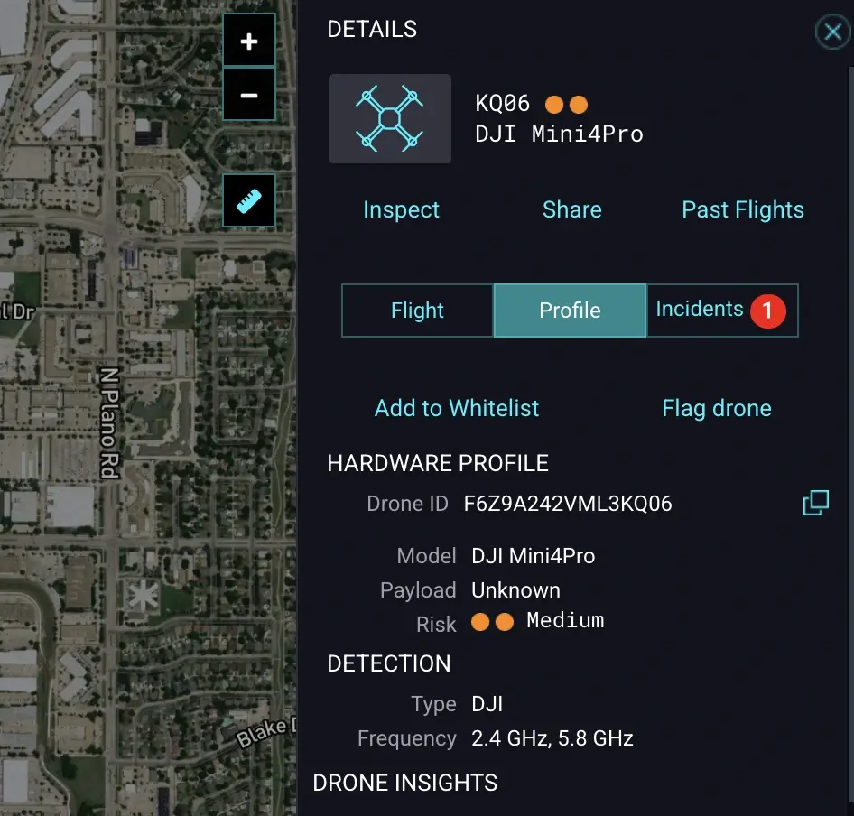
Drone Whitelisting & Flagging
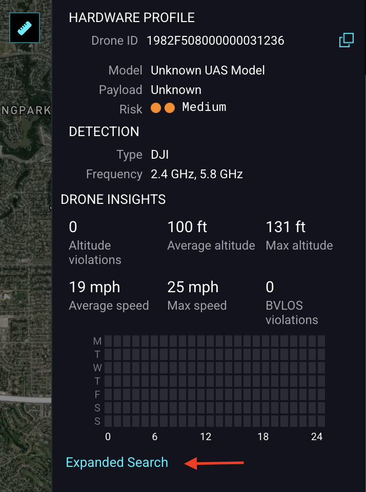
Expanded Nationwide Search
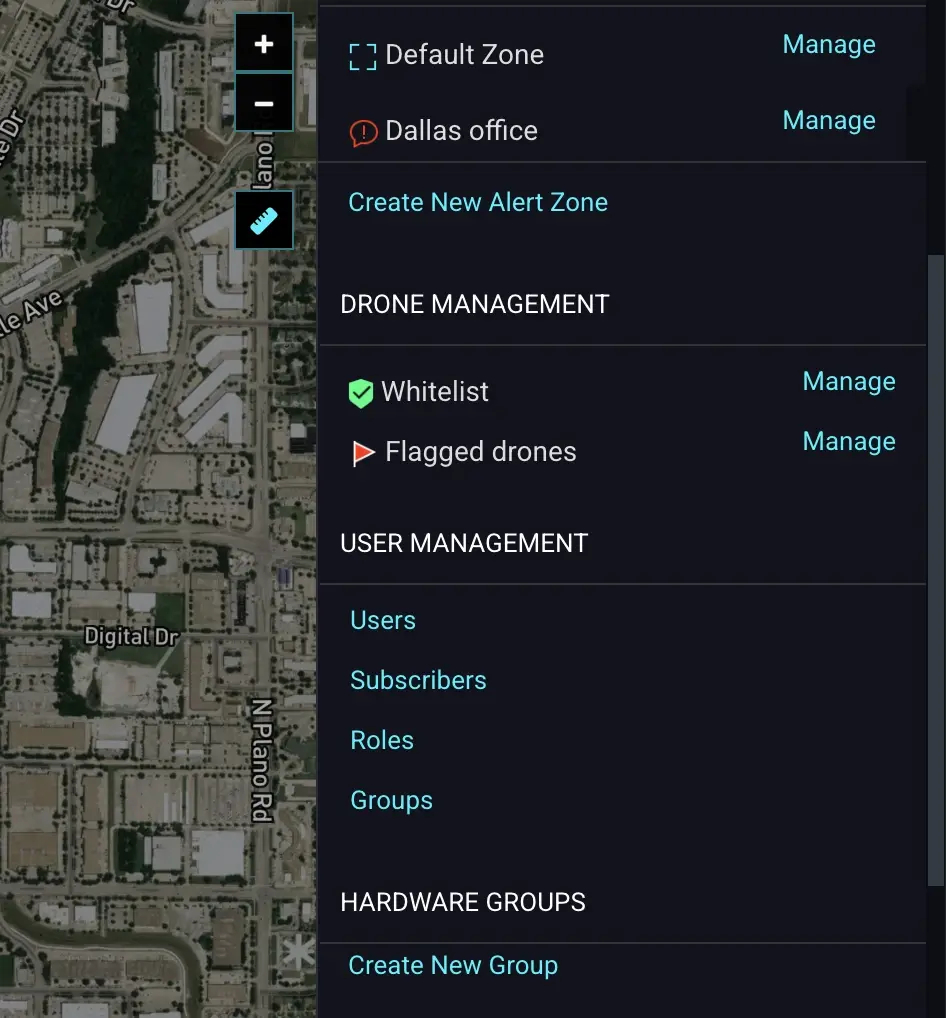
Advanced User Management & Permissions
Verified Alerts with 24/7 Human Monitoring
Hardware Layers of the
AirGuard Drone Detection Platform
We partner with best-in-class manufacturers to provide a hardware-agnostic, multi-layered detection shield that adapts to your specific security needs.
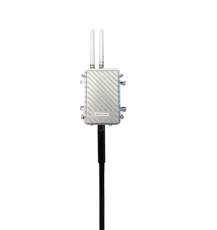
Remote ID Compliance
The foundational layer. Detects all new compliant drones and older models updated with FAA-required Remote ID firmware. Provides precise drone and pilot GPS location within a 2-to-5-mile range.

RF/DF Detection
Detects non-compliant, "silent," and DIY drones. Our sensors identify specific RF protocols to pinpoint the drone and pilot location, expanding coverage up to 10km (6 miles).
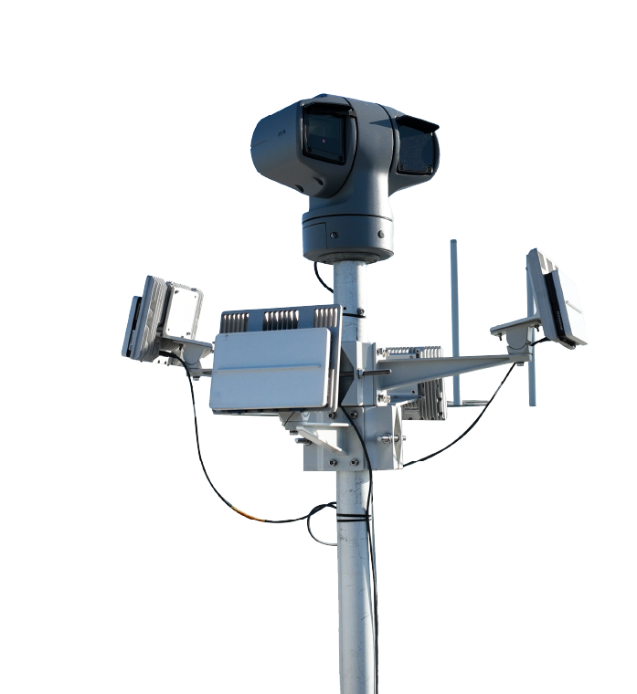
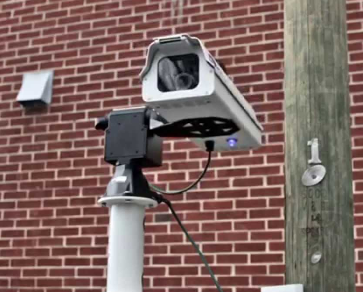
Radar with Visual Camera
The ultimate defense. Radar detects all flying objects, including non-RF "Dark Drones". Triggers visual verification backed by AI classification and 24/7 human monitoring.
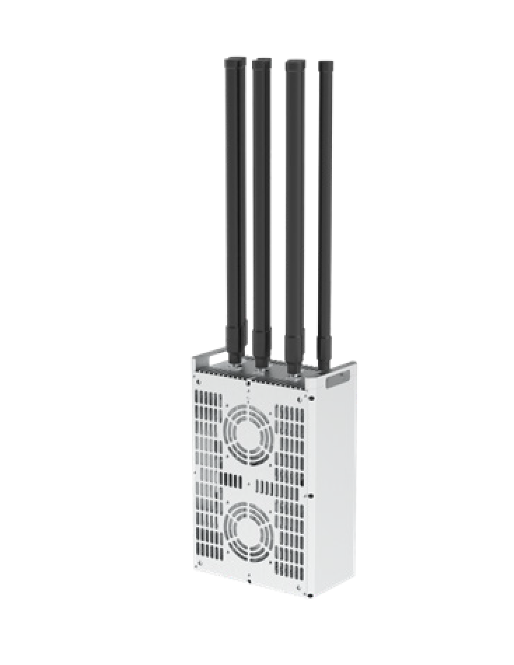
Jammer & Mitigation
Active countermeasures to neutralize hostile threats. This hardware disrupts control signals, safely forcing drones to land or return home.
*Available exclusively for FAA-approved federal entities.
AirGuard Detection Tiers
The multi-layered sensor approach at AirSight gives you the choice between four detection tiers. Here's what each tier includes:
| Feature | Basic | Essential | Enhanced | Complete |
|---|---|---|---|---|
| Remote ID Detection Detects compliant drones and pilot location within 2-5 miles |
✓ | ✓ | ✓ | ✓ |
| Real-Time Alerting Instant notifications for unauthorized drone activity |
✓ | ✓ | ✓ | ✓ |
| Pilot and Home Location Tracks drone operator's live GPS location |
✓ | ✓ | ✓ | ✓ |
| Unlimited Users Full platform access for unlimited team members |
✓ | ✓ | ✓ | ✓ |
| Enhanced RF Detection Identifies non-Remote ID drones within 2-5 miles |
✕ | ✓ | ✓ | ✓ |
| Multi-Sensor Integration Combines data from multiple sensors |
✕ | ✓ | ✓ | ✓ |
| Directional RF Detection Identifies non-Remote ID drones and their direction within 2-5 miles |
✕ | ✕ | ✓ | ✓ |
| Radar Detection Detects all flying objects, including non-transmitting drones |
✕ | ✕ | ✕ | ✓ |
| AI Aircraft Type Classification Classifies and differentiates drones from other airborne objects using AI |
✕ | ✕ | ✕ | ✓ |
| Live Human Confirmation Manual confirmation using visual identification |
✕ | ✕ | ✕ | ✓ |
| Visual Camera Integration High-resolution imaging for visual verification |
Add On | Add On | Add On | ✓ |
How Does AirGuard help you respond to aerial drone threats?
AirGuard empowers your team to track both drones and pilots to respond proactively to threats before they can cause damage. Our solution provides real-time insights and customizable features that help secure your airspace, allowing you to make informed, data-driven decisions for enhanced threat response.
AirGuard empowers your team to track both drones and pilots to respond proactively to threats before they can cause damage. Our solution provides real-time insights and customizable features that help secure your airspace, allowing you to make informed, data-driven decisions for enhanced threat response.
-
Visualize the threat by distance.
-
Create warning and alert zones.
-
Create SOP based on actionable data.
-
Detailed flight path history.
-
Pilot historical location.
-
Special Interest location heatmaps.
-
Improve SOP’s based on Analytics and Data.
-
Integrate into other security systems.
Frequently Asked Questions
How does the AirGuard platform differ from a standard security camera or perimeter alarm system?
Traditional security systems are designed to protect your ground-based perimeter, leaving your airspace as a significant blind spot. AirGuard is purpose-built to secure this third dimension. It doesn't just detect an object; it provides actionable intelligence on aerial threats, including the drone's real-time GPS location, its flight path, and, most critically, the live location of the pilot. This allows your team to move from a reactive to a proactive security posture.
My main concern is with non-transmitting or 'dark' drones. Can your system detect those?
Yes. We understand that not all threats transmit signals. This is why we utilize a multi-layered sensor approach. While our Remote ID and RF sensors detect the vast majority of consumer and commercial drones, our Complete Tier solution integrates high-resolution radar. Radar detects all flying objects based on their physical characteristics, regardless of whether they are transmitting signals, ensuring that even pre-programmed or modified drones are identified.
My team is already managing multiple security platforms. How does AirGuard integrate, and will it add to operator overload?
AirGuard is designed to simplify, not complicate, your workflow. The platform acts as a single pane of glass, fusing data from all our sensors into one intuitive interface. It can be easily integrated with your existing VMS, command-and-control platforms, or other security systems. Furthermore, features like intelligent threat classification, customizable visual and sound alerts, and our 24/7 human verification service (in the Complete Tier) are designed to reduce operator fatigue and ensure your team only focuses on credible, verified threats.
We operate in a busy area with a lot of bird activity. How does your system mitigate false positives?
Minimizing false positives is a core part of our system's design. Our platform uses advanced signal processing and an AI Aircraft Type Classification engine that analyzes reflected signals and compares them to a vast database of drone signatures to differentiate them from birds or other non-threatening objects. For maximum reliability, our Complete Tier adds a final layer of 24/7 Live Human Confirmation, where our expert team visually verifies alerts to ensure you only respond to real threats.
Beyond live alerts, what tools does AirGuard provide for forensic analysis and evidence gathering?
AirGuard is a comprehensive forensic tool. Every flight detected in your airspace is recorded and stored in the Flight History log. You can replay any incident in detail, analyzing the drone’s flight path, speed, and altitude. For evidence, you can export flight data and video recordings. Additionally, our unique Expanded Search feature allows administrators to track a drone's activity across our entire national network, helping to identify repeat offenders and build a more comprehensive case for law enforcement.
We have multiple sites with different security needs. Is the AirSight solution scalable and customizable?
Absolutely. The AirSight solution is designed for scalability and flexibility. You can create an unlimited number of custom geofenced alert zones within your primary detection area, each with its own notification rules. Our robust user management system allows you to create custom roles and assign specific permissions, ensuring team members only have access to the information and controls relevant to their responsibilities, whether they are managing a single location or overseeing security across an entire region.
Do you manufacture your own detection hardware?
AirSight is a software and systems integration company. We do not manufacture our own hardware. Instead, we partner with the world's leading hardware manufacturers to source best-in-class sensors. Every piece of hardware we deploy undergoes a rigorous and continuous testing process by our team to ensure it meets our high standards for performance and reliability. This hardware-agnostic approach allows us to design the most effective, tailor-made solution for your specific environment without being limited to a single brand of technology.
We are a security integrator. Do you offer a partner program for companies that want to sell your solutions?
Yes, we do. The Airsight Partner Program is designed to empower security integrators, resellers, and technology alliances with cutting-edge drone detection solutions. We provide our partners with the tools, training, and support needed to drive revenue and deliver high-value airspace security to their customers. Benefits include competitive discounts, deal registration protection, joint go-to-market planning, and access to sales and marketing assets. We look for partners with experience in physical security and a strong customer base in sectors like critical infrastructure, corrections, and stadiums.

