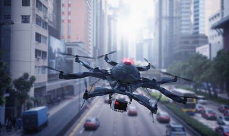
Introduction: Why Radar Detection?
At AirSight, we believe that transparency is the foundation of a strong partnership. This guide is created to provide a clear, high-level overview of the real-world factors that influence the performance of any radar-based drone detection system.
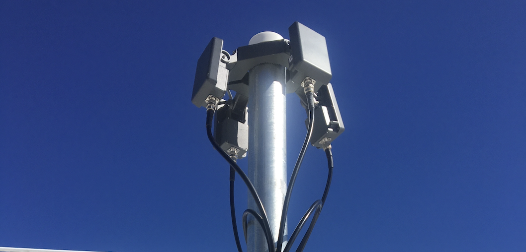
This includes our Complete tier solution, which utilizes the state-of-the-art EchoDyne EchoGuard radar. By understanding the principles and limitations of radar, we can set accurate expectations and design the most effective security solutions for our customers.
How Does Radar Drone Detection Work?
Unlike passive RF sensors that "listen" for drone signals, radar systems are active sensors. They operate in two steps:
- Transmit: The system transmits radio frequency energy (electromagnetic waves) into the airspace.
- Listen: It then "listens" for the reflections (echoes) that bounce back from objects in the sky.
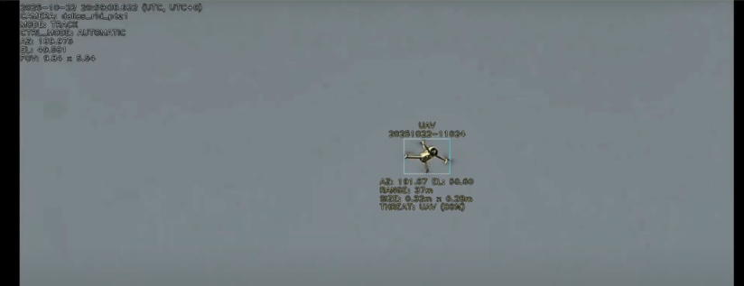
When these returning waves are detected, advanced machine learning algorithms analyze the signal's characteristics—such as its size, speed, movement pattern, and radar cross-section—to classify the object as a UAV, bird, vehicle, or other target.
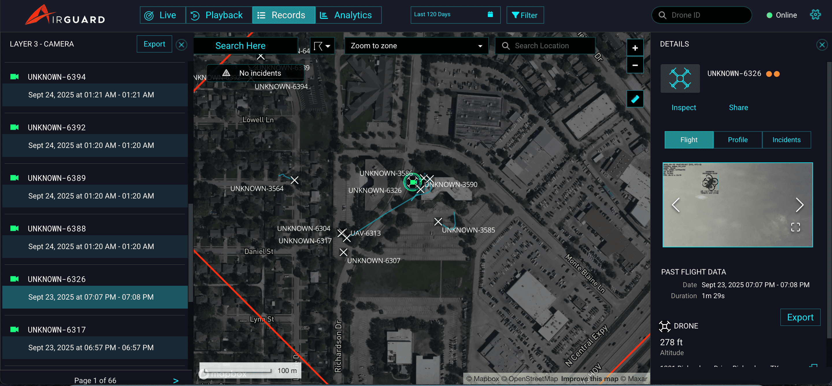
A complete radar solution, like our Complete tier, combines the radar with an AI-powered Pan-Tilt-Zoom (PTZ) camera. Once the radar detects a target, it automatically cues the PTZ camera to that location for visual verification.
What Factors Affect Radar Detection Performance?
The performance of any radar system is fundamentally influenced by the laws of physics and the environment in which it operates.
Environmental Factors: The Laws of Physics in Practice
- Line of Sight (LOS): Radar waves travel in straight lines and cannot pass through solid metallic obstacles. While not as strict as passive RF, a clear, unobstructed view of the airspace significantly improves detection range and quality.
- Obstructions and Material Impact: Every object between the radar and the target can absorb, reflect, or scatter the signal.
- Metal Structures: Water towers, metal roofs, and fencing create severe blockages and strong reflections.
- Concrete and Masonry: Dense buildings significantly absorb and block radar energy.
- Foliage: Trees and vegetation cause moderate signal attenuation, which worsens when the foliage is wet.
- Weather Conditions: Unlike RF sensors, radar performance is directly affected by weather.
- Heavy Rain and Snow: Precipitation absorbs and scatters radar energy, which can significantly reduce detection ranges and degrade track quality.
- Fog and Humidity: These conditions can also have a moderate impact on performance.
- Environmental Clutter: The density of objects in the radar's field of view directly impacts performance.
- Urban/Dense Areas: This is the most challenging environment for radar. High concentrations of buildings, vehicles, and metal structures create significant ground clutter, which consumes the radar's processing capacity and reduces detection range.
- Rural/Open Areas: Fewer obstructions allow for maximum detection ranges. However, high bird activity becomes the primary challenge in these settings.
- Electromagnetic Interference (EMI): High-power transmission lines and other strong EMI sources can significantly degrade radar detection performance and classification accuracy.
Why Are Some Drones Harder to Detect?
Beyond the environment, the drone's physical characteristics play a critical role in how easily it can be detected by radar.
- Size and Radar Cross-Section (RCS): Smaller drones with minimal radar cross-sections are inherently more difficult to detect. A large DJI Matrice provides a much stronger radar return than a small, open-frame FPV racing drone.
- Construction Materials: Drones built with materials that do not reflect radar energy well—such as certain plastics, carbon fiber, or composite materials—are more challenging to detect. Home-built FPV drones are particularly challenging due to their open frames and minimal reflective surfaces.
- Speed and Altitude: Drones flying at very high speeds (typically above 15-20 m/s) can pose tracking challenges. Additionally, a drone flying outside the radar's vertical field of view (too high or too low) cannot be detected.
The Classification Challenge: Why Radar Sees Birds
One of the most significant real-world challenges for any radar system is distinguishing between drones and birds. Both present similar radar signatures: small, flying objects with movement patterns that can overlap.
Advanced radars like the EchoDyne EchoGuard use machine learning classifiers that analyze speed, size, movement patterns, and Doppler signatures to differentiate targets.
However, no classifier is perfect. In environments with high bird activity (common in rural settings and prisons), false positives will occur. It is critical to understand that radar is not a foolproof system that will catch every target 100% of the time without errors.
Real-World Performance Expectations
The following estimates are based on AirSight's extensive field testing with the EchoDyne EchoGuard, using a DJI Mavic 3 or Air 3 sized drone. Actual performance at your specific site will vary.
Detection Range by Environment
|
Environment Type |
Detection Range |
Key Challenges |
|
Ideal (Rural/Open) |
~1,000 meters |
High bird activity (false positives) |
|
Suburban |
600-800 meters |
Moderate clutter, partial obstructions |
|
Urban/Dense |
300-500 meters |
Severe clutter, metal structures |
Detection Range by Drone Size (Ideal Conditions)
|
Drone Type/Size |
Approximate Range |
|
Large drones (DJI Matrice, Phantom 4) |
1,000-1,500 meters |
|
Medium drones (DJI Mavic 3, Air 3) |
900-1,000 meters |
|
Small drones (FPV racing, mini drones) |
400-600 meters |
Key Takeaway: Real-world detection ranges are highly site-specific and will vary based on environmental conditions, weather, clutter, and drone characteristics.
When to Use Radar: The Role of the Complete Tier
Radar serves as the "catch-all" solution in AirSight's multi-tiered security approach. While RF sensors (found in our Basic, Essential, and Enhanced tiers) are excellent at detecting drones broadcasting signals, radar provides complementary capabilities.
What Radar Detects That RF Sensors Cannot:
- "Dark Drones": Drones that do not emit any RF signals, such as those on pre-programmed GPS waypoints or using cellular communication.
- RF-Disabled Drones: Drones with intentionally removed or disabled transmitters and Remote ID systems.
- Spoofed GPS Drones: Radar detects the true physical location of a drone, even if it is broadcasting false GPS data.
- Visual Verification: Radar-cued PTZ cameras provide visual confirmation of all detected targets.
What RF Sensors Provide That Radar Cannot:
- Drone & Pilot Identification: RF sensors (available in our Basic tier and up) can capture Remote ID data, including the drone's serial number and the operator's real-time GPS location.
- Greater Range for Compliant Drones: For high-power drones like those from DJI, RF sensors can often achieve detection ranges far exceeding radar's typical range.
Use Case Guidance
Radar (included in the Complete tier) is Essential When:
- You require complete "catch-all" detection, including non-compliant or "dark" drones.
- Visual verification of all targets via PTZ camera is necessary.
- You are in a high-security environment (prisons, critical infrastructure, data centers).
- You face a threat from sophisticated actors who may use RF-disabled drones.
RF Sensors (Basic, Essential, or Enhanced tiers) May Be Sufficient When:
- Your primary concern is monitoring compliant commercial drones.
- You are in a lower-risk threat environment.
- You understand and accept that RF-silent or non-compliant drones may not be detected.
The AirSight Advantage: Partnership and Performance
Understanding radar's challenges is the first step to overcoming them. At AirSight, we use this knowledge to our customers' advantage:
- Vendor-Agnostic Approach: We continuously evaluate and integrate the best-in-class radar systems, like the EchoDyne EchoGuard, to ensure our customers benefit from the most advanced solutions.
- Rigorous Testing: Our performance estimates are based on extensive field testing in diverse environments, not on theoretical manufacturer claims.
- Multi-Tiered Security: We champion a comprehensive approach that combines our RF-based tiers with our radar-inclusive Complete tier to create a robust solution that addresses each technology's limitations.
- Meticulous Calibration: Radar deployments require careful, on-site calibration of both the radar panels and PTZ cameras, followed by fine-tuning with test drone flights.
- Professional Site Surveys: Our expert team conducts thorough site assessments to identify challenges and strategically position sensors to maximize coverage.
By being transparent about radar's capabilities, we can work together to build the most effective and reliable drone detection solution for your unique operational needs.