Skip to content

AirSight Metro

Affordable airspace intelligence for cities, counties, and towns.

AirSight Metro combines real-time and historical drone detection with ADS-B data on manned aircraft in one shared, live view for police, fire, EMS and emergency management. Start with three Remote ID sensors.

45–65 mi²
Coverage per 3-sensor network
Scalable
Add sensors at any time
Drones + aircraft
Drone detection and ADS-B in one view
Live Remote ID detections, fused across the city S1onlineS2onlineS3online Scroll

The state of things today

The sky over your city just got crowded.

Many cities, counties, and towns still have areas with no drone detection sensors and no platform to tell an authorized drone from an unauthorized one when it counts. Part of the reason is cost: most drone detection solutions are priced with enterprise budgets in mind.

  • No detection coverage across the jurisdiction
  • No way to tell authorized from unauthorized
  • No view of nearby manned aircraft
  • No drone history beyond the city line

Without intelligence on what is overhead, agencies are left guessing instead of knowing, and reacting instead of preventing.

THE SOLUTION

Citywide coverage that fits your budget.

One plan that suits your jurisdiction. It runs on the AirGuard Cloud at a fraction of the cost of traditional detection.

AirSight Metro

One affordable plan

Full coverage with a new network of three Remote ID sensors that can be expanded at any time.

$13,950 / year

Billed annually on a 3-year plan. No hidden fees.
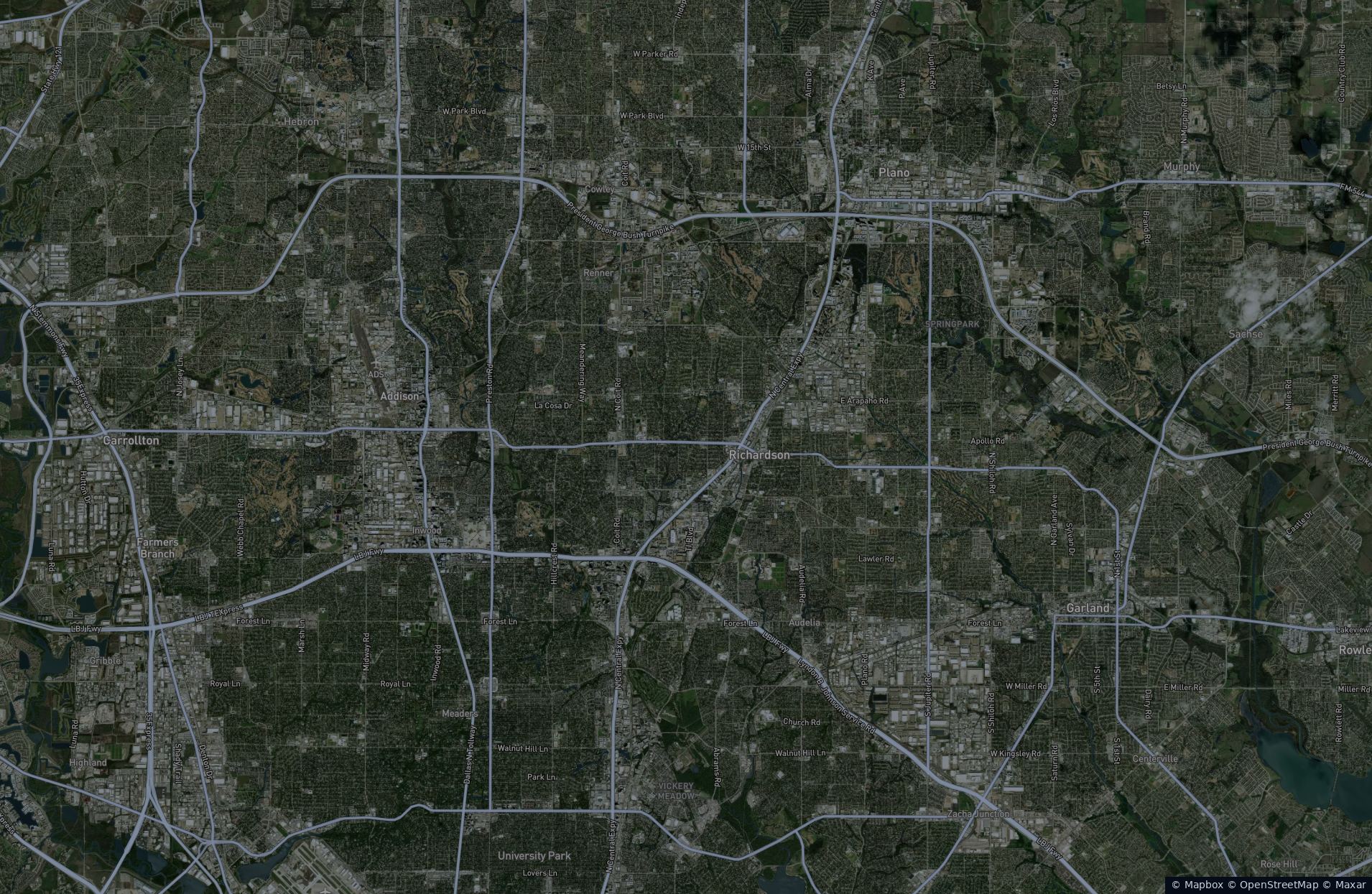
3 sensors · 45–65 mi²

Included

  • 3 Remote ID sensors with 45–65 sq. mi. of overlapping 360° coverage, or any layout you need
  • Live ADS-B feeds for manned aircraft
  • Drone detection data integrated with your DFR system
  • Expanded Nationwide Drone Search, with 3+ years of data
  • Records, Playback and Analytics in AirGuard
Book a Demo

We will walk through coverage for your city, county, or town.

Included with the plan

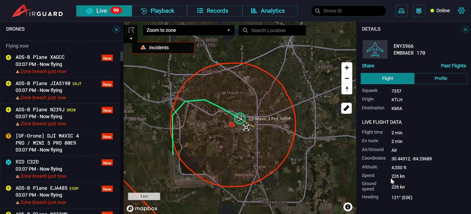
  • Real-time ADS-B with aircraft type, altitude, speed, heading, origin, destination and ICAO address. Every flight is saved to Records and Playback.

  • Model, ID, altitude, speed and location of the drone, plus where the pilot is standing. Review any flight in Records or replay it step by step.

  • Once a drone is detected in your zone, look up its ID across more than three years of national detection data and see every sighting mapped across the country.

Benefit from existing integrations with other law enforcement technology partners, including DFR, for no additional cost.

AirSight Metro by department

Built for every department in your jurisdiction.

Select a department to see how AirSight Metro helps.

Stop contraband drops and find the pilot outside the fence.

See every broadcasting drone near the facility and where its pilot is standing.

  • Pilot locationPatrol responds to the operator, not the package.
  • Perimeter alert zonesInstant alerts by pop-up, email and text.
  • Repeat offendersSee where the same drone has flown nationwide.
Illustrative night aerial of a floodlit correctional facility with a small drone approaching the housing units and a pickup truck parked at a pull-off on the county road
Illustrative render

Already running a DFR program?

AirSight Metro for DFR adds airspace awareness to every flight with minimal infrastructure. Your DFR fleet, nearby drones, and manned aircraft appear on one map. Drone detection data is also integrated with your DFR platform.

Explore AirSight Metro for DFR

How it works

How AirSight Metro works

  1. AirSight Metro detects drones overhead, while ADS-B adds manned aircraft.

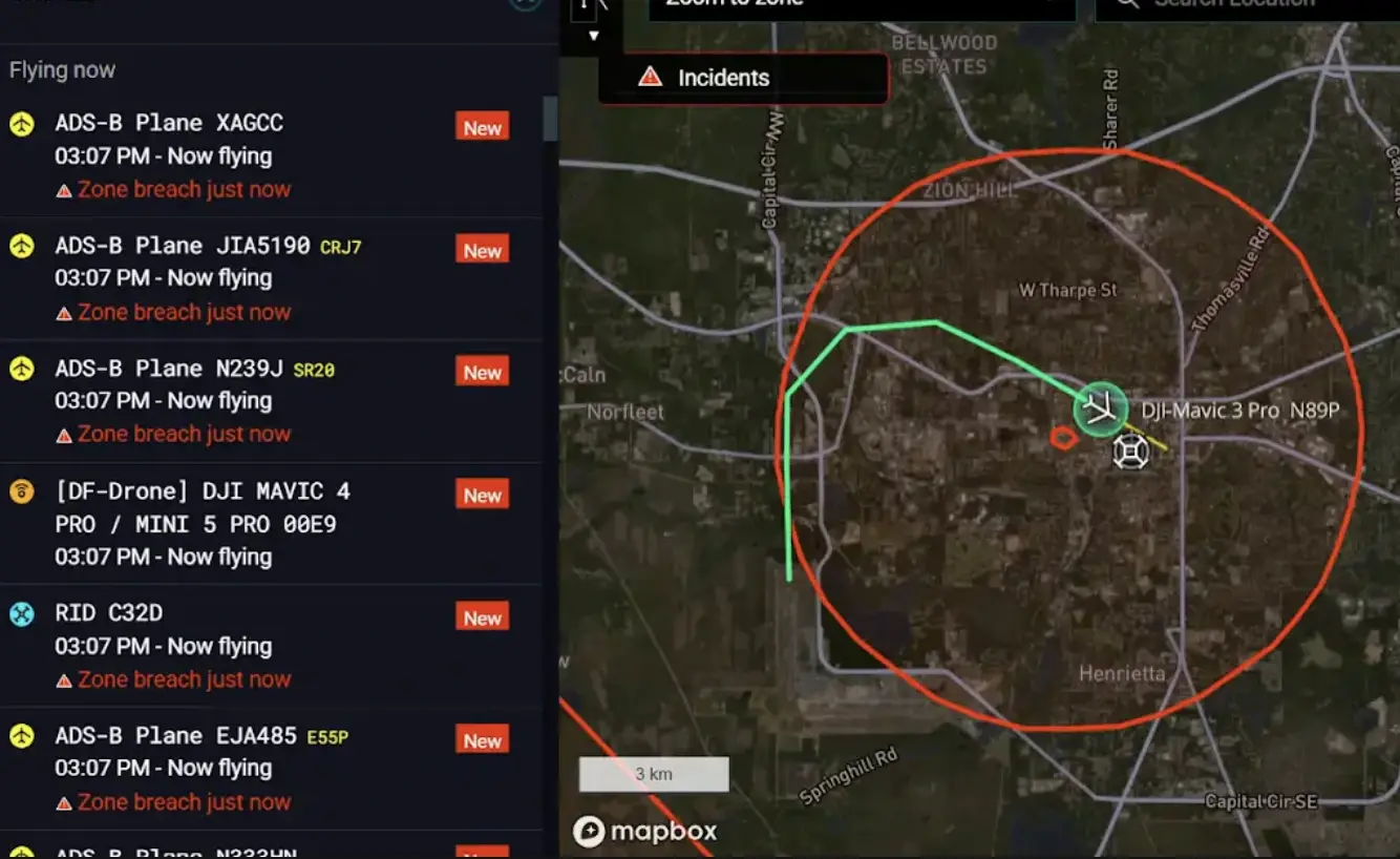
  2. Sensor feeds connect securely to the AirGuard Cloud and merge into one real-time picture of drones and manned aircraft.

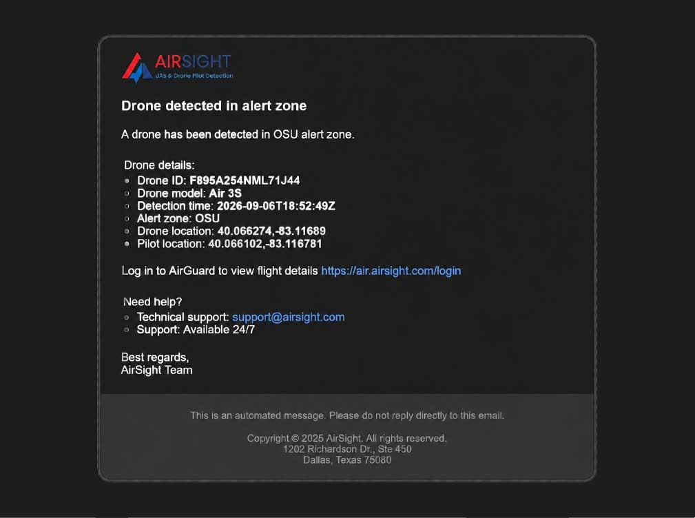
  3. Operators get the drone’s model, ID and altitude, the GPS location of the drone and its pilot, and type, altitude and heading for each manned aircraft.

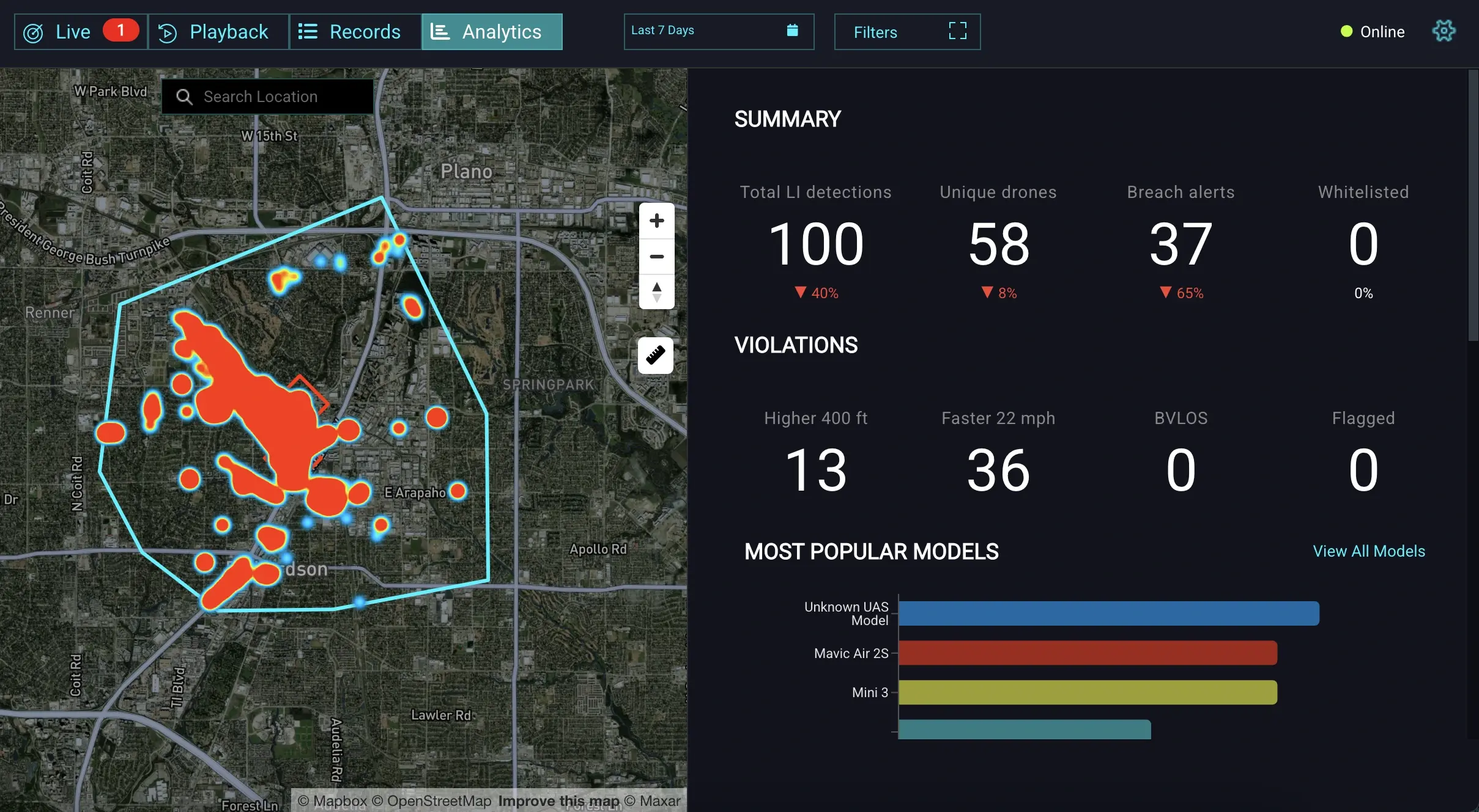
  4. Records and Playback cover every logged flight. Analytics and Expanded Nationwide Drone Search shows where a drone has been seen across the country.

  5. Police, fire, EMS, and the EOC work from the same live view.

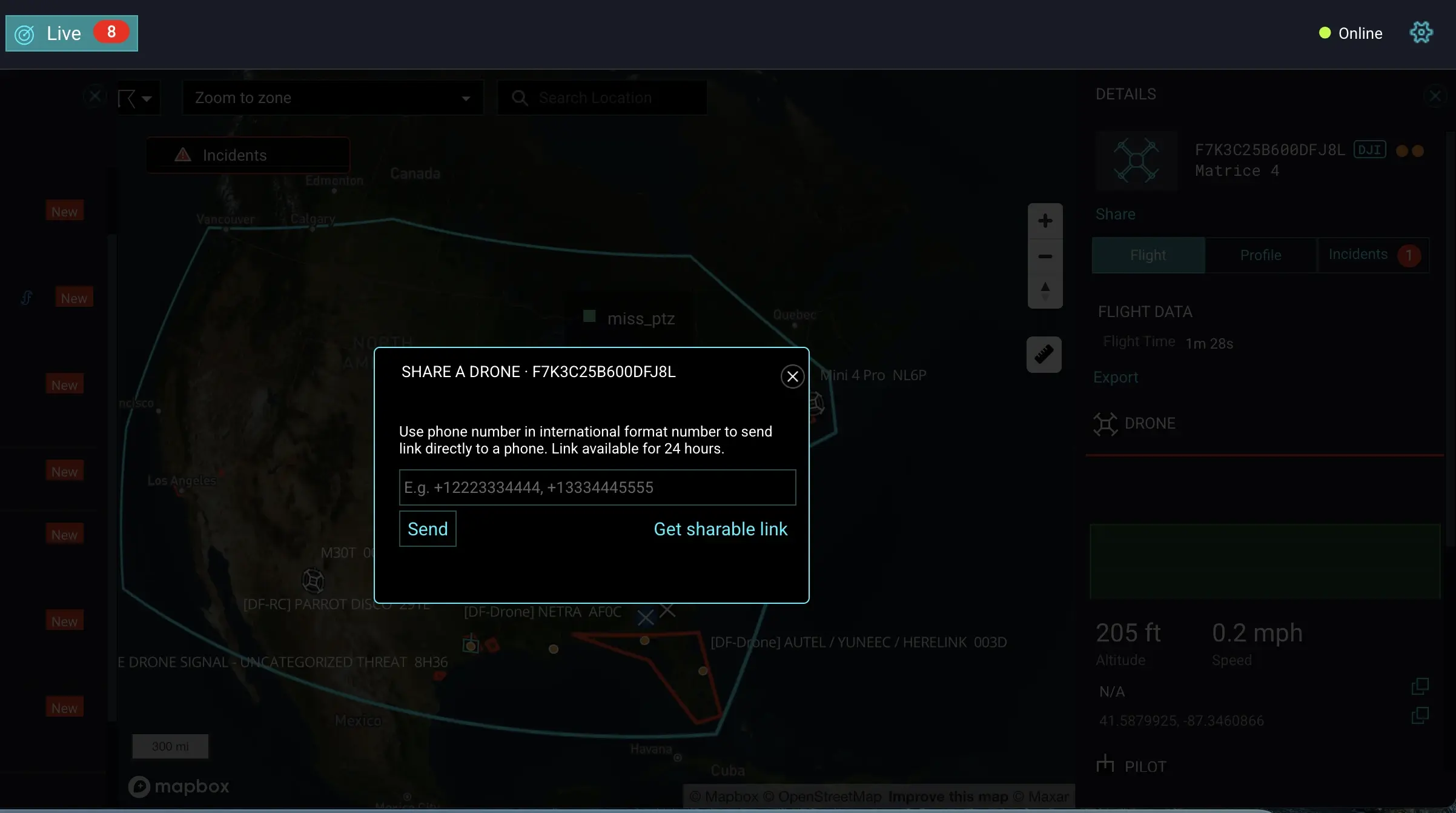
Illustrative AirGuard screens with sample data.

01

Detect

AirSight Metro detects drones overhead, while ADS-B adds manned aircraft.

  1. Step 01/ 05

    Detect

    AirSight Metro detects drones overhead, while ADS-B adds manned aircraft.

  2. Step 02/ 05

    Fuse

    Sensor feeds connect securely to the AirGuard Cloud and merge into one real-time picture of drones and manned aircraft.

  3. Step 03/ 05

    Alert

    Operators get the drone’s model, ID and altitude, the GPS location of the drone and its pilot, and type, altitude and heading for each manned aircraft.

  4. Step 04/ 05

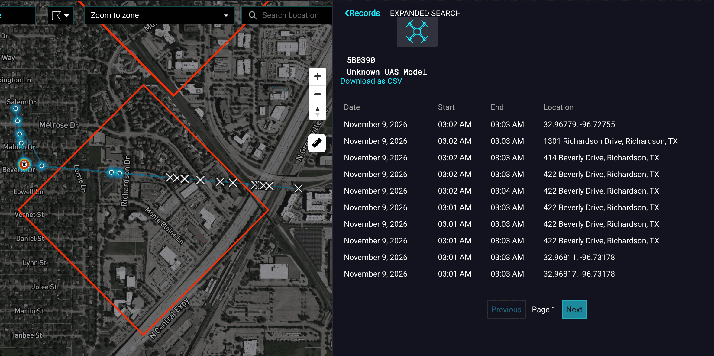
    Investigate

    Records and Playback cover every logged flight. Analytics and Expanded Nationwide Drone Search shows where a drone has been seen across the country.

  5. Step 05/ 05

    Share

    Police, fire, EMS, and the EOC work from the same live view.

Illustrative AirGuard screens with sample data.

Why AirSight Metro

Why cities choose AirSight Metro

  • Instant identification

    Distinguish authorized DFR and delivery drones from unauthorized flights.

  • Predictable pricing

    Billed annually on a 3-year plan with no hidden fees, built for cities, counties, and towns.

  • Drones and aircraft, one view

    Remote ID drones and ADS-B manned aircraft on the same live map.

  • Scalable by design

    Start with the coverage you need now and add sensors as your program grows.

Robert portrait 2 Robert TabbaraFounder and CEO, AirSight
AirSight Metro gives cities, counties, and towns affordable, citywide airspace awareness. Because drones and manned aircraft appear together on one screen, teams can see everything flying overhead and tell an authorized aircraft from an unauthorized one, past or present. The platform makes local airspace a source of actionable intelligence that improves public safety and emergency response.

FAQ

Frequently asked questions

11 questions

Still have a question? Our team can walk you through coverage for your city or county.

Talk to our team
What does AirSight Metro detect, and what does it not detect?

AirSight Metro detects drones that broadcast Remote ID, the digital identification the FAA requires most drones to transmit. Each detection shows the drone's position, altitude, speed, heading, model and serial number, plus the location of the pilot's control station. Drones that do not broadcast Remote ID, such as older, homebuilt or modified aircraft, are not visible to Remote ID sensors. For sites that need that coverage, AirGuard adds RF, radar and camera layers to the same platform.

How do we start with AirSight Metro?

You deploy a new network of three Remote ID sensors, which covers about 45 to 65 square miles with overlapping 360° coverage. The plan includes ADS-B data on manned aircraft, Expanded Nationwide Drone Search, and records, playback, and analytics in AirGuard. For LPR and DFR integrations, review our AirSight Metro for DFR program.

Is AirSight Metro legal for our agency to use?

Yes. AirSight Metro is detection only. It passively receives the Remote ID signals drones are required to broadcast, and it does not jam, take control of or interfere with any aircraft. To understand what agencies can do after a detection, read our SAFER SKIES Act guide.

Does AirSight Metro show manned aircraft?

Yes. ADS-B data is included with the plan. Helicopters and airplanes that broadcast ADS-B appear on the same live map as drones, with aircraft type, altitude, speed, heading, origin, destination and ICAO address. Past flights can be reviewed on the Records and Playback pages.

What is Expanded Nationwide Drone Search?

Once a drone is detected in your zone, you can look up its ID across the full AirGuard national database, which holds more than three years of detection data. You see everywhere that drone has been detected, even outside your own geofenced zones, mapped across the country. It helps investigators spot repeat offenders.

We already own drone detection sensors. Can we use AirSight Metro?

Yes. We can work with your existing sensors for a custom price. We connect your own drone detection sensors to AirGuard, alongside any AirSight sensors already in your area, and add ADS-B and Expanded Nationwide Drone Search, so every department works from one citywide view. You can add AirSight Remote ID sensors at any time to extend coverage. Get a custom quote.

How reliable is the pilot location?

The pilot location comes from the drone's own Remote ID broadcast, which reports the position of the control station. In most cases that is where the operator is standing. Accuracy depends on the GPS in the drone and controller.

How does coverage work in dense or hilly areas?

Three sensors typically cover 45 to 65 square miles with 360° overlapping coverage, or can be arranged in a custom layout around your priorities. Actual range depends on terrain, building height and sensor placement, so we map coverage and agree on sensor locations with you during scoping. More sensors can be added at any time.

How much does AirSight Metro cost?

AirSight Metro is $13,950 per year, billed annually on a 3-year plan with no hidden fees. It includes three Remote ID sensors, live ADS-B feeds, drone detection data integrated with your DFR system, Expanded Nationwide Drone Search, and Records, Playback and Analytics.

How do agencies pay for AirSight Metro?

AirSight Metro is an annual subscription, and you can expand as your needs grow. Many agencies fund drone detection through federal and state programs. Our Counter-UAS Grant Funding Guide explains how.

We are starting a DFR program. How does AirSight Metro help?

AirSight Metro shows drones and manned aircraft already in the air before each launch and separates your own DFR flights from unknown drones. If your team already flies DFR and needs airspace awareness, AirSight Metro for DFR adds deconfliction and integrates drone detection data with your DFR platform, all with minimal infrastructure.

See AirSight Metro over your jurisdiction.

Book a 30-minute demo to see the platform and live alerting, get a coverage estimate for your area, and find out how it fits your city, county, or town.